
Guide Sections
- About this guide
- About The Colorado Trail
- Time of the year to hike The Colorado Trail
- General Safety
- Durango or Denver bound?
- Waterton Canyon and alternate Denver starting points
- Budget
- Guidebooks and maps for The Colorado Trail
- Collegiate West alternate
- Collegiate Loop
- Collegiate West vs Collegiate East?
- Equipment for The Colorado Trail
- Resupply on The Colorado Trail
- Alternate Routes and 14ers on The Colorado Trail
- Getting to and from Denver
- Getting to and From Durango
- Section hiking Transportation and Shuttles
- Hiking The Colorado Trail with a dog
- Other Colorado Trail Resources
CLICK HERE TO SAVE THIS GUIDE FOR YOUR OFFLINE USE – Print this guide or save in PDF for your local use. The best method for smartphone use. 🙂
About The Colorado Trail and the “End to End” Guide

While this handout will help you prepare for the basics on a journey of this trail, it is not the only item you need for information to complete The Colorado Trail. As always, you should consult with other resources before heading out on an extended trek in the mountains.
Revised November 2025
Want to know the major details about The Colorado Trail?. Here are the particulars in a nutshell:
- The official length of the trail is just under 500 miles.
- Northeastern terminus just outside of Denver in Waterton Canyon State Park
- Southwestern terminus just outside of Durango, CO
- Highest official point is 13240 ft
- Lowest point is 5520 ft
- According to the latest figures, The Colorado Trail averages 10347′ throughout its length!
- The CDT and The Colorado Trail share the same treadway for 234 miles; over 300 if you take the Collegiate West option.
- It takes most hikers 4-6 weeks to hike the trail.
- Five weeks is a very average pace.
- Well-marked and easy to follow
- Horses and mountain bikers (in non-wilderness areas) are also allowed in addition to hikers
- Alternate routes for mountain bikers

The Colorado Trail map from The Colorado Trail Foundation.
The window for hiking The Colorado Trail is relatively narrow. Generally speaking, the window for hiking the CT is no earlier than mid- to late June (depending on snowpack) and no later than late September/early October. Before mid- to late June, there is generally too much snow in the high country, even in a lower-snow year; after late September/early October, there is a very good chance of a snowstorm that will accumulate and not melt the following day.
For the increasing number of people hiking the Colorado Trail from out of state, July 1st or later is a safe date to plan for a start. I would not count on mid- to late June or earlier. For more information, see what Bill Manning, a previous Executive Director of The Colorado Trail Foundation, wrote.
Here’s a very detailed and statistic-based Colorado Trail “Class of 2016” post. The post also contains some fantastic information worth reading.
If you are Denver-bound, the hiking season can be extended by about 1 week, since you will be at lower elevations at the end of the trail.
This time frame is just a rule of thumb that can vary depending on snowpack, hiking pace, snowmelt rate, and early winter conditions. The rule of thumb is pretty accurate, however. This link from The Colorado Trail Foundation may be helpful as well.
| Start Date | Conditions | Pros | Cons |
|---|---|---|---|
| Late June | Early-season snow at high elevations, lingering mud, variable stream crossings | Quiet trail, full of wildflowers at lower elevations, cooler temps | Postholing, slower progress, some resupply towns still sleepy, higher insect activity |
| Early to Mid-July | Snow mostly gone except in north-facing basins, and creeks still flowing well | Prime alpine conditions, flowers peaking, most services open, long daylight | Crowds increasing, afternoon thunderstorms begin in earnest |
| Late July to Early August | Peak season; alpine fully accessible, stable trail conditions | Ideal balance of weather and access, reliable resupply | Thunderstorms almost daily, bugs at their peak, very busy trail and towns |
| Mid to Late August | Cooler nights, fewer bugs, thunderstorm cycle begins to ease | Quieter trail, golden light, early signs of fall colors | Shorter days, some seasonal services start to wind down |
| Early September | Crisp weather, foliage in early phases, fewer people | Excellent conditions, less monsoonal moisture, empty trailheads | Risk of early snow at high elevations, colder nights, some water sources drying up |
| Mid to Late September | Snow possible above 11,000 ft, most services winding down or closed | Stunning aspens, solitude, true shoulder season feel | Increasing risk of storms, resupply tougher, snow gear may be needed |
| PROS | CONS |
|---|---|
| Cool crisp weather | Less daylight |
| Fewer people | Always a chance of freak snowstorm |
| Aspen are changing, gorgeous! | In a low snow year water flowing less |
| Elks bugling | Colder at night |
| Less danger of lightning |
(Note: Fall generally comes to The Colorado high country by late August)
Now, with changing weather patterns, the above rules of thumb are getting skewed. Not uncommon to have 90+ F days in the foothills with frequent afternoon t-storms as well in September. Very unusual and, if the hot and dry patterns hold going forward in the years ahead, hard to tell what is in store! The monsoon season may be off or even short as in recent years, possibly even more wildfires, and a prolonged fall/later winter. We’ll see what Ma Nature does. That’s about all we can do. 🙂
The trail itself: The Colorado Trail is very well marked for a western trail. Navigation is easy, the weather hazards (see below) are quickly dealt with, with some prior planning, and the trail is logistically easy. A great trail for a first long hike and/or to get a western trail experience! For recent updates on the trail itself, be sure to check out The CTF webpage with current trail conditions.
Hiking solo: Enough people are hiking The Colorado Trail, especially in July and August, that it will be very easy to hike with others if so desired. There is a community on the trail and in towns. You will see fellow CT travelers along the way. If you absolutely want a solo experience, hiking towards fall would be best.
Hitching: Hitching into town to resupply is usually needed. Along the CT corridor, locals are very used to CT hikers, and obtaining a ride is usually not an issue. If you do not feel comfortable solo hitchhiking and don’t have a formal partner, you can generally partner up with someone as the town gets closer. Also, ask at the trailhead for a ride usually works too. It should be noted that more local businesses in towns are also offering shuttle options.
Mobile device coverage: For the stretch from Denver to Copper Mountain (excluding the Lost Creek Wilderness), coverage can be OK to excellent. Outside of this segment, mobile device coverage is spotty. Obviously, do not depend upon a cell phone for safety. Even in known good coverage areas, cell phone coverage can be spotty at times. At some high points and near busy roads into town will be best overall, regardless of location. This link for cell phone coverage will give more coverage info and for your particular carrier.
About lightning: Lightning is a natural phenomenon that many CTers are most concerned about. During The Colorado summer, around mid-July to about mid-August, thunderstorms start brewing around one or so in the afternoon and go until late afternoon. Almost like clockwork! When planning your mileage for the day, keep this in mind. Ma Nature doesn’t always stick to this schedule, but she’s consistent about it for the most part! I’ll typically take a break and then continue on in the late afternoon and take advantage of the later daylight summer hours.
About “Da Bears”: While there are black bears on The Colorado Trail, they are not even as remotely aggressive as their High Sierra cousins. Black bears tend to stick to valleys and are not habituated to backpackers like their Sierra cousins. A bear canister is overkill (IMO); standard bear precautions should be plenty. At this time, bear canisters are not required on The Colorado Trail
The exception for bear precautions on The Colorado Trail is below.
Nicely summed up by Jerry Brown of Bear Creek Survey:
Hikers need to be aware that the USFS has just enacted new restrictions regarding food storage which is in effect for San Isabel and Pike National Forests. This affects both the CDT and CT where they cross popular car camping roads. The regulation requires that food be stored in hard canisters or hung 10 feet above ground 4′ from the trunk of the tree. No consideration is given for Ursacks, so I think they will need to be hung within the described zones. The zones are 1/2 mile wide (1/4 mile on each side of the roads.) Roads included are Halfmoon, Winfield, Hancock, Cottonwood, Mt. Princeton/ Chalk Creek, and Buffalo Creek/ Little Scraggy on the CT. These restrictions include portions of both the Collegiate East and West routes for the CT.
For most hikers of The Colorado Trail, the primary place impacted will be the popular USFS Bootleg campground near Princeton Hot Springs. As of Sept 2017, there is a bear box in the camp for food storage. Currently closed, check the link for updates.
What about bear spray?
You’ll find that most experienced people in the black bear country say you don’t need it. Myself included.
However, I also recognize that this issue can be emotional for many people. If you are part of the “better to have it and not need it” crowd, by all means, take it if it makes you feel better. But, and this is a very BIG but, please do the responsible thing and practice using it first.
Cabelas, REI, and similar sell inert training canisters for about $25 each. Get two or three canisters and practice in real conditions, holstering and unholstering it with your gear (poles included) and spraying in moderately windy conditions.
LEOs, rangers, game wardens, and even volunteer scientists (like my partner in Glacier) do this very thing in the backcountry as part of their required training.
If you are going to take a canister into the backcountry without knowing how to use the tool correctly, you are merely giving lip service to safety.
At best, you’ll use the tool ineffectively when it counts. And you may accidentally harm yourself and others because of your lack of responsibility.
Do the right thing; if you take a bear spray canister, practice first.
(* While In-person training is always better for this type of skill, various organizations offer online 1 hr training classes to get you the basics before you practice in the field. https://bearsafety.com/services/bear-spray-training )
CORSAR card?: Despite popular misconceptions, the CORSAR (Colorado Outdoor Recreation Search And Rescue) card is not insurance. The CORSAR card is essentially a charitable donation to help defray the cost of training and rescues for the hard-working SAR groups in Colorado. No surprise, these SAR groups are bustling in Colorado—a sound card to buy to help out a bit.
SOUTHWEST vs. NORTHEAST on The Colorado Trail
Southwest / Durango Bound Starting from Denver eases a hiker into the higher elevations, starts off more gently, more options to bail out if you need some RnR. You also get to end in the San Juans, a much more scenic ending than Waterton Canyon. Due to the elevation factor, this method is preferred for people from outside of Colorado. Durango has fewer transportation options to get home than Denver does.
Northeast / Denver Bound: You do face some of the most challenging terrain and higher elevation right away, and end in the more subtle Waterton Canyon. The end of the trip will prove to be easy terrain-wise. If you start late in the season, going Denver-bound extends the hiking window by about 1 week, to early-mid October, depending on that season’s weather. Ending in Denver is also much easier logistically to get back home vs Durango.
Starting in Denver
There are three popular places to start the Colorado Trail from Denver.
The Official Start – Waterton Canyon
Waterton Canyon is the official Denver terminus of The Colorado Trail
Waterton Canyon is perhaps the logistically easiest of the three popular starts, is the official trail terminus, and allows the CT hiker to ease into the trail gently. Seeing the bighorns at the dam is always a treat, too.
This start does not allow dogs or camping, however. It is also essentially a wide dirt road and a very popular trail for running/biking/fishing area, so it doesn’t feel very remote as a start.
The Dog-Friendly Start – Indian Creek Trail
Have a dog and do not want to skip ahead to segment two? You could do this dog-friendly alternate (with somewhat challenging logistics).
If you wish to have long-term parking for this alternate, for Denver in general, here’s some info posted online:
If you’re starting at the Indian Creek TH, parking in Sedalia might be convenient. Maybe phone Sedalia RV Storage (303) 688-3842, owner Jim Sikora, and get a price quote, etc. There are many other RV storage facilities you might also inquire at, but some won’t take cars.
Other people have confirmed that this is a good option.
Besides allowing dogs, the alternate start features a campground at the beginning, and camping is permitted along the way.
The Scenic Alternate – Roxborough State Park
Another alternate start could be to take this alternate, not far from Waterton Canyon. Roxborough State Park does not allow camping or dogs, butit is an interesting and scenic alternative. Take trail #800 to hook up with The Colorado Trail again. It hooks up again just after Waterton Canyon at Lenny’s Rest.
Here’s a little report I wrote about it. Makes a nice way to start The Colorado Trail. (With some caveats: There is an entrance fee, no overnight parking, no camping, no horses, no MTBikes, or dogs)
If you do not find a shuttle (see below), you can get there via these instructions:
- Rail from the airport to Union Station –
- Walk to the nearby light rail station on 16th Street Mall.
- Light Rail to Mineral – Littleton station
- Take a taxi to Roxborough State Park. Uber or Lyft is an option as well.
Excellent overview of the three alternates via The Colorado Trail Foundation.
Starting from Durango? See below!
Guidebooks
The following are good Guidebooks for The Colorado Trail
- The Colorado Trail: The Official Guidebook, Tenth Edition. By The Colorado Trail Foundation,
“The tenth edition of The Colorado Trail has all the information a day hiker, thru-hiker, mountain biker, or equestrian needs to plan and complete a trip on the Colorado Trail. Written descriptions for all 28 segments of the trail, plus 5 segments of the Collegiate West, have been updated throughout the guide. The guidebook includes updated amenities in each trail town for resupply, shopping, and lodging, as well as current details on wilderness detours for bikepacking routes.” - The Colorado Trail: The Trailside Databook, 8th Edition. By The Colorado Trail Foundation The Colorado Trail’s equivalent to the AT databook. Compact enough for a good-sized cargo pocket. Ounce for ounce and dollar for dollar, the most valuable guidebook for the CT. Has quick resupply info, alternate routes for mt bikers, and more.
Maps:
The following represent a wide range of map resources for The Colorado Trail.
- USFS Maps in Guidebook: Some basic maps do come with the guidebook, but they are limited in scope, do not show alternate routes/bailout points and have no topo lines. Some people find them adequate; I do not like using them. YMMV.
- The Colorado Trail Map Book: A map set available on the The Colorado Trail Foundation website for $40: CT Topo Map Book: “Detailed, up-to-date topographic maps and waypoints help you navigate The Colorado Trail and plan your trips. Includes recent trail reroutes in Clear Creek and Cataract Ridge. Soft cover, 8.5″ x 11″ and spiral bound to lay flat for ease of use, it weighs only 14.5 ounces. Can be disassembled allowing users to carry just what they need. (Paper is not waterproof and packing in a Ziploc bag is recommended.) Includes 73 pages of full color, shaded relief topo maps detailing The Colorado Trail and the bicycle detours around Wilderness areas. Magnetic declinations for compass users. Complete printed list of nearly 1200 GPS waypoints in UTM & Lat Long formats.” Additional detail is available on http://bearcreeksurvey.com/colorado_trail_mapbook.htm
-
- Note: These maps are very detailed but only show the CT corridor. If you want to take alt routes, “bag” some of the more obscure 14ers, or prefer a wider view than just the CT corridor (for bailout points, perhaps) you may want to take different maps or the Bear Creek maps with the appropriate sections of the DeLorme Gazetteer for Colorado or the Benchmark Atlas. Taking the narrow corridor maps with the appropriate atlas maps is a strategy many CDT hikers use for their thru-hikes FWIW. The maps are also available in electronic form.
-
- Another option is the MOUNTAIN MAPS – SAWATCH RANGE map that shows alternate routes, 14ers, and bailout points between Leadville and the CDT/CT junction to the south (. Sections 10-15 in the guidebook.)
- Trails Illustrated Maps: Very detailed with an excellent overview of not just the trail, but surrounding trails as well. Good if you plan on taking alternate routes and/or doing 14ers. They are water-resistant. Cost ~$13 ea. A bit heavy. You need fourteen maps to complete the trail, so it can be an expensive option. Being a Colorado resident, already owned many of the maps anyway, so it was an option that worked for me. If you do not plan on hiking in Colorado again any time soon, the other map resources are a better investment.
- NatGeo Trails Illustrated maps cover The Colorado Trail North and The Colorado Trail South.
- The Latitude 40 Maps aren’t as detailed as other maps but cover a wider area. Suitable for on-trail hiking and bail-out points. The new maps for the Collegiates (Buena Vista and Salida) are confirmed to cover the new Collegiate West route as well. The Summit County, Salida/BV, and Durango maps cover the CT from Kenosha Pass (70 miles) to the end, less money than using all TI maps, again with less detail.
- FarOut (Guthook) has a Colorado Trail app for iOS and Android platforms. Maps, trail info, profiles, resupply info, as well as info for the Collegiate West option and mountain bike detours. The app includes user notes on water, campsites, and other helpful information for hikers.
- Gaia GPS features the entire trail as the default base map.
The guidebook, databook, and map book can be ordered from The Colorado Trail Foundation. Many bookstores in Colorado have the guidebook and data book. Amazon and other online resources also carry the guidebook.
Trails Illustrated maps can be found at www.trailsillustrated.com, Amazon, and many local outfitters stores in Colorado. If you decide to use the TI maps, you will need the following to cover the whole trail.
-
- #104 Idaho Springs/Loveland Pass
- #105 Tarryall Mountains/Kenosha Pass
- #108 Vail/Frisco/Dillon
- #109 Breckenridge/Tennessee Pass
- #110 Leadville/Fairplay
- #126 Holy Cross/Reudi Reservoir
- #127 Aspen/Independence Pass
- #129 Buena Vista/Collegiate Peaks
- #130 Salida/St. Elmo/Shavano Peak
- #135 Deckers/Rampart Range
- #139 La Garita/Cochetopa
- #140 Weminuche Wilderness
- #141 Silverton/Ouray/Telluride/Lake City
- #144 Durango/Cortez
Note: These maps are not in trail order and are listed in numerical order as put forth by National Geographic/Trails Illustrated. The trail winds in and out of these maps, and listing them in trail order would be cumbersome, whereas the number order is more convenient for purchasing. The Colorado Trail guidebook lists the appropriate map to use for each section.
- GPS Waypoints: For those who wish to enter waypoints for their GPS software, such as Gaia or Caltop,o and do not wish to enter them manually, Bear Creek Survey has their waypoints available for downloading to your GPS
Not sure what resources to take? From what I can tell, here are the most popular resources in terms of use:
- The Colorado Trail Databook is, in my opinion, the most useful purchase for quickness and battery life.
- My guide for basic town and mileage info seems to be well-used
- The FarOut Guides (Guthook App) for the Colorado Trail navigation. A smart device has largely replaced a dedicated GPS for consumer-level use. Uses the Bear Creek Maps.
- The Colorado Trail Guide for pre-trail planning, trailhead info, and post-trail recollection. Very useful if section hiking, as the trailhead directions are very detailed.
- The NatGeo Trails Illustrated print maps that cover The Colorado Trail North and The Colorado Trail South. A good compromise between details, an overview beyond the trail corridor, and weight. At ~$30, an affordable alternative as well.
- Note that Gaia GPS app has a similar version of the maps via their default map set.
- Less used: Other alternate resources for data books, alt routes, or planning
If I personally did the CT again? I’d take the databook, The Colorado Trail North, and The Colorado Trail South maps, and I’d have my town info saved on a mobile device.I would not need the FarOut (Guthook) CT app, but it could be helpful to for notes and potential camping spots in addition to trail news. I’d also download the waypoints as noted above and use Gaia GPS in the field.
Permits: No permits are needed to hike The Colorado Trail. In some areas, such as the Holy Cross Wilderness, there is a self-issued permit station when entering the wilderness. There is no charge for this permit.
However, starting in the summer of 2020, you’ll need an SWA Pass to traverse segment 12 of the Collegiate East. “CT Segment 12 travelers will need a valid fishing or hunting license or risk being fined, typically $100, though authorities indicate they’ll get more serious with fines starting in 2021.” Please see the Colorado Trail Foundation blog for updated 2023 details and information on purchasing a day pass.
Collegiate West Alternate
As of 2013, there is a higher alternate route on The Colorado Trail that takes in the existing Continental Divide National Scenic Trail through the Collegiate Peaks. This route is the same length as the current CT (~80 miles) through this section, but offers a higher ridge walk alternative that many people may find interesting. Alpine lakes, ridge walks, and above-treeline views are to be found. See below for more info.
Collegiate West vs. Collegiate East?
On The Colorado Trail, two “designated” alternates are roughly the same mileage. Between Twin Lakes and Monarch Pass, the CT splits for ~80 miles between the two Collegiate routes.
Which option to hike?
- The Collegiate West option is more scenic, more remote-feeling, and is on or near the Continental Divide. Simply stunning. However, it is more exposed.
- The Collegiate East is the older and lower version of the CT. Best if the weather is going to be iffy, don’t enjoy the high elevation as much, and want something less remote.
This post from the FKT Proboards by Eric Truhe nicely sums up the stat differences between the Collegiate East and the Collegiate West options:
For CT East versus CT West clarification, according to the CT Guidebook (9th Edition):
The CT via the CT East is 484.6 miles with 87,645 feet of climbing (Durango to Denver)
The CT via the CT West is 489.7 miles with 89,665 feet of climbing (Durango to Denver)
Specifically:
The CT East section is 78.1 miles with 15,038 feet of climbing (south to north)
The CT West section is 83.2 miles with 17,058 feet of climbing (south to north)
Thus, the CT West section is 5.1 miles longer with 2,020 feet more climbing (south to north)
However, it is important to note that the 78.1 mile CT East section is at an average elevation of 9K-10K feet, while the 83.2 mile CT West section is at a much higher average elevation of 11K-12K feet. While the CT East route does top out above 11K feet a few times, the CT West route has whole sections that run above 12K feet (for example, the CT West route has a 15-mile section that runs between 12K-13K feet)!
The CT “West” route could be more aptly named the CT “direct” as it goes through the Collegiate Peaks mountains, rather than around to the “West.” The higher mileage, climbing, and average elevation, make the CT West route more challenging (and in my opinion, more aesthetically pleasing) than the CT East route.
My 2017 Collegiate Loop hike also has some photos that contrast the two routes.
Budget
How much will it cost to take a hike on The Colorado Trail?
That is a question with many different answers depending on your hiking style, the length of your trip, how many town stops you make, the cost of transportation to the trail, etc.
In general assuming an average hike of The Colorado Trail of 4-5 weeks, figure roughly $1300 +/- taking into account of inflation vs years past. This price does not include gear or transportation costs to and from the trail.
A way to save money is to limit town stops and overnight stays in particular, only purchase food for re-supply purposes, do not indulge in any alcohol, and limit side trips while in town such as rafting.
Equipment for The Colorado Trail
If you are an AT or another long trail veteran, most of your gear and clothing choices should work fine. Some caveats do apply:
- You are hiking at altitude! UV radiation is more intense; sun exposure is a significant concern. Sunglasses and sun protection are a must! Wear sunscreen and/or a large hat, along with long sleeves and long pants. Even the dime-store sunglasses now offer 100% UVA and UVB protection.
- You will want to be hydrated as well. Sun exposure increases your risk of dehydration. A dehydrated body does not work efficiently. Drink!
- If you are a hammock camper, you will want to be more careful in picking your campsites. Some of the CT is above treeline, so fewer options. In some cases, lots of “widow makers” due to pine bark beetle kills, unfortunately.
Fuel canisters should be found in the following places. As more people are now hiking The Colorado Trail and the coinciding Continental Divide Trail, it is strongly suggested to call ahead to be sure of availability in these sometimes smaller stores.
- Denver area – Pick one!
- Bailey – Platte River Outfitters – 303-816-9383/ 303-895-7229 .
- Fairplay – Prater’s Market (719) 836-1618 – Fairly easy hitch past Jefferson. The market reported that it had canisters in stock.
- Fairplay – High Alpine Sports – (719) 836-0201
- Breckenridge – Mt Outfitters – 970-453-2201
- Dillon – REI – (970) 468-0161
- Frisco – Walmart – (970) 668-3959 larger 8oz or 16oz isobutane
- Silverthorne – Wilderness Sports -(970) 468-5687
- Twin Lakes – General Store – 719-486-2196 Limited quantity reported; may want to call ahead.
- Leadville – Leadville Outdoors (719) 486-7392
- Buena Vista – Trailhead Sports – 719-395-8002
- Princeton Hot Springs – PHS Store – (719) 395-2447 – Store reported having some canisters in stock.
- Salida – Salida Mt Sports – 719-539-4400 – Monarch Crest Store (limited quantity reported)- 1-719-539 4091
- Creede – San Juan Sports – 719-658-2482
- Lake City – Sportsman Outdoor and Fly Shop – 970-944-2526 High Country Market 970 944-0161
- Silverton – Outdoor World – 970-387-5628 – Silverton Hardware (970) 387-5774
- Gunnison – A few different choices among the outdoor stores, Walmart, and possibly hardware stores.
- Durango – Many choices as well (if not as many as Denver..go figure! ;D)
Note: There may be more stores than listed. Feedback always welcome. I’d be lying if I said I visited or know about every outdoor store in the state. 😉 Also, the small town’s stores can change or run out of inventory esp as more people hike The Colorado Trail and the CDT. Always good to call ahead.
With more wildfires and drier conditions in the American West, open flame bans are becoming more common.
What this often means is that, in addition to campfires, stoves without an on/off valve are frequently banned. That means alcohol- and Esbit-stoves. You can go stoveless, use a canister stove, or go with a white gas stove. Some years, even white gas stoves get banned. Naturally, wildfires will affect trail closures or even resupply.
Resupply
Resupply is similar to the PCT: not overly complicated, but with fewer choices and longer hitches than on the AT. Because the CT is relatively short, mail drops are a viable option for many thru-hikers, especially those on a fast pace with limited time. Below is a list of popular re-supply areas, with approximate mileage from Denver for each. Also, have a brief description of each town for supply purposes. This is not a complete description by any means, but it does give a brief overview of some of the more popular options.
Maildrops vs resupply in towns
Places with adequate supplies for CT travelers are not in short supply. Oatmeal, Ramen, bars, cheese, etc., are all staples in good supply for people on the CT. Buying as you go works for most people on their CT journey.
When to use maildrop (a package of supplies mailed to yourself)?
Maildrops are simply mailing pre-made food parcels to post offices, hostels, or other areas along the trail. The advantage of this method is that the supplies are waiting in a package for you.
A hiker will pick up their package, dump the food in their pack, and go. The disadvantage of this method is that you are dependent on Post Office hours (if not sending to a hostel or business), have to pay for shipping, and need a person on the home front to send out packages for you. Unless you have special dietary needs or are on a time crunch, there is no real reason to use maildrops regularly.
As mentioned, many towns on the CT have good-sized grocery stores and other resupply areas.
If you use a maildrop, be sure to mail out as the example below shows:
Jane Hiker
c/o General Delivery
Some Town, CO 55555
Please hold for CT hiker, ETA 7/23/28
The post office will generally hold your package for up to two weeks. Be sure to have an ID ready when you pick up your package. If possible, you may want to mail a package directly to a hostel or business rather than the post office. The hours will be longer and more flexible.
A mail drop works best if:
- Have dietary needs (vegan, GF, etc.) that are not easily addressed via a typical town resupply.
- Prefer to pick up meals you made yourself, be it for nutritional or personal taste.
- On a time crunch, grabbing a package saves time vs. shopping in town.
Note, you can mix and match, too. Send maildrop to the place where the selection is limited; buy where there are full-service options.
**** Due to the increasing popularity of The Colorado Trail, it is suggested that you contact a business first before you send a mail drop ****
And speaking of towns and interaction with hikers…
Remember, hiking The Colorado Trail is a privilege and not a right. Always say “Please” and “Thank you”, don’t act like you are entitled to anything because you are a long-distance hiker, and respect not only your fellow hikers but also the people in the towns you are entering. Remember, your actions can affect the hikers who come after you.
The Appalachian Long Distance Hikers Association has an excellent set of guidelines at the “Hike in Harmony” site. Think of it as LNT trace ethics for hikers in town.
![]()
On to the resupply info…
- Marginal resupply – Soda, chips, snacks. Maybe some Ramen or canned goods if you are lucky. Hard resupply basically.
- Moderate resupply – All the basics, if not many choices. Your typical small-town grocery store. You’ll be able to get everything you need for a few days of the trail.
- Full Service – Has a supermarket, lodging, restaurants, often an outfitter of some sort. Anything you need will probably be in this town.
Please Note: As with all mountain areas, the places below can be busy on weekends and holidays leading up to Labor Day Weekend. Don’t be surprised if the accommodations are full for a busy summer weekend! Wildfires can also affect town resources or even cause outright closures.
Air BnB and VRBO are increasingly popular options for lodging in some of the more popular tourist towns the CT, as an FYI.
Also, new commercial enterprises are mailing out food, gear, and other sundries to hikers. Quite a few may be found via a Google search such as, but not limited to, Trail Supply Co, Outdoor Herbivore, Zero Day Resupply, and Sonora Pass Resupply.
Some hikers are using Amazon Pantry Service or the Walmart equivalent, too.
Also, this information can change… even during a season. If there is incorrect/additional info, please send feedback. Thank you!
| Resupply Spot | Miles From Denver (rounded) | Miles From Trail (rounded) | Notes |
| Denver | 0.0 | 0.0 | A large metro area with everything you may need. Near downtown, there is an REI. |
| Conifer | 17 | 15 | Large town with many restaurants, retail stores, grocery stores, PO, etc. |
| Buffalo Creek | 27 | 3. | Very soon into the trail if you need to bail or want to get a cold Coke. Small general store with marginal resupply. PO inside the general store. Ask nicely, and you may be able to get a package outside of regular business hours. |
| Bailey | 41 | 8 | Lodging (just outside of town), restaurants. The resupply at the gas station is marginal—basic camping items, such as Sasquatch Outpost and Knotty Pine. Platte River Outfitters will accept maildrops only via UPS and FedEx. Stocks canisters, dehydrated food, and snacks. Some backpacking supplies: “More the place for forgot this, forgot that” “Shuttles when we can”
The town does have a PO if you want to do a maildrop. Bailey may be an option if you need some R&R while getting your trail legs. FS-560 receives a decent amount of traffic on weekends. Two Bridges Lodges (the former site of Lynwood Park) offers a hiker hostel, holds packages, and performs local shuttles for guests—more info – https://www.twobridgeslodge.com/. RSVP is not required but preferred. |
| Jefferson / Fairplay | 72 | 5 | Jefferson:
No hiker services per se, but many like the Hungry Moose Caboose BBQ. Fairplay: Small, compact town past Jefferson with everything a hiker may need. Good-sized grocery store, lodging, and restaurants. Outdoor store. Relatively easy hitch on 285. Brewery, too. From this point, Bailey may also be hitched back to ~19 miles north on 285. |
| Breckenridge/Frisco/Dillion | 104 | 4 | Breck: Full-service town. The bus will stop at the trailhead and take you into and out of town for free. Fireside Inn is a hiker-friendly hostel with bunk rooms. Takes maildrops via UPS and FedEx only . www.firesideinn.com
The Bivvi offers a bunk-and-breakfast stay. Book online with code “HikeCO” for a discount.. Prices do go up for last-minute bookings. “Hot tub…outdoor firepit..draft beer”. On the free bus line and next to Breck brew pub (or a .5 mile walk)! On-site laundry services now. Takes mail drops. See website for more info. Frisco: Another full-service town with outfitters, grocery stores, etc. The same free bus will take you in the other direction to Frisco. Frisco is a full-service town with more affordable lodging (esp. if you want a private room). Silverthorne/Dillon: Full-service town. The Summit County Bus will also take you a little further into nearby Dillon/Silverthorne. More lodging, stores, and BREW PUBS! |
| Copper Mtn / Frisco | 119 | 0 | Copper: Ski Resort, NO POST OFFICE! Very marginal resupply. Many restaurants. Follow CT into Copper at American Eagle Ski Lift. Follow the side trail into “town”.
Frisco: You can pick up the same free bus in Copper (Summit Stage) as you do in Breck. It will take you to Frisco. |
| Leadville | 143 via US 24 at Tennessee Pass | 10 | Full-service town. Leadville Hostel is now:
Inn the Clouds – Leadville’s Hostel & Inn InnTheCloudsHostel@gmail.com (719) 486-9334 maildrop for guests (yes) shuttles for a fee when time permits (yes) Showers for walk-in’s Free wifi |
| 158 via Haggerman Rd FS-105 | 11.0 | The FS roads see a fair amount of traffic, especially on weekends. It could be an easy hitch. US 24 at Tennessee Pass sees the most traffic. Many people bagging Elbert and Massive make hitching from Half-moon easy as well (esp. on weekends) | |
| 171 via Halfmoon Creek Rd. FS-110 | 8.0 | ||
| Twin Lakes | 176 | On-trail or 1-3 miles. Depends if you use alt. road walk route, old CT over Hope Pass, or current CT route | General store with basic backpacking food and supplies. Moderate re-supply. Resupply packages info at this link: http://www.twinlakesgs.com/ Two small motels. Other lodging (cabins, lodges) just outside of “town”. |
| Collegiate West alt route info is below Durango. | Collegiate West alt starts just past here, at ~mile 14 of segment 11. Please see below, Durango, for resupply info on Collegiate West alt route | ||
| Buena Vista | 191 via Clear Creek Rd/RT 390 then US 24 | ~20 | Full-service town. Different lodging options. All roads see a fair amount of traffic esp on a weekend, but 306 sees the most traffic and is by far the easiest hitch.
New hostel – BV Overlook with hiker accommodations and tent sites. Local shuttles. Some hiker supplies are in store per the website. https://www.bvoverlook.com/ |
| 210 via 365 | 7 | ||
| 217 via 306 | 10 | ||
| Mt. Princeton Hot Springs | 230 | 0 | On-trail resort. Princeton Hot Springs General store/marginal to moderate re-supply. Restaurant, lodging, and hot springs you can soak in for a day. May take maildrops if you call ahead. www.mtprinceton.com Rooms and day-use hot springs available. |
| Salida | 248 via CO 240
253 via US 50 |
13 to Salida | TH at 240 is for “Angel of Shavano”, a 14er. On weekends, there could be a decent amount of traffic.
Otherwise, you may want to hike ~5 miles more to US 50, then hitch. US 50 is a much busier road. Simple Lodge and Hostel low-cost bunks. In downtown near all amenities. They do take mail drops. Offer bikes for getting around town. www.simplelodge.com Many local places shuttle MTBikers to the nearby Monarch Crest Trail which is part of the CT/CDT Hayduke’s Hideout hostel is available as of May 2021. This business takes maildrops. Roxy’s Bottle Shop 102 E Rainbow Blvd. Salida, Co 81201. 719-539-4163 Approx. 5 miles to the west is the town of Poncha Springs, with restaurants, lodging, gas stations with limited supply, a post office, and a brewery! The Monarch Mountain Lodge (Garfield) is about five miles below Monarch Pass. Previous owners have let people park here if hiking the Collegiate Loop. The Butterly Hostel is a popular option for both collegiate West and East hikers. Various ways to reach, including a two-mile hike down a jeep road. Takes maildrops. See https://www.monarchbutterflyhouse.com/ |
| COLLEGIATE WEST ALT ROUTE ENDS HERE AND REJOINS CT | 267 | ||
| Sargents | 267 | 15 | Tough hitch on a traffic road. Marginal resupply. PO. Lodging in cabins. Bar and grill. http://www.tomichicreektradingpost.com/ |
| Saguache / Gunnison | 303 | Saguache is approx 30 miles EAST. | Note: I was hesitant to add this info, but I have received some e-mails about it. I also had to use this point as a bailout point during a hefty snowstorm on my CDT hike in 2006. Though this is a hard and long hitch in both directions, it could be useful for patient people and/or those who really need to bail
.Saguache: This county seat has a few small businesses that have been known to be for sale. As for this writing, the town has two gas stations for min–moderate resupply, restaurants (breakfast, lunch, dinner), lodging, and a post office. |
| Gunnison is approx 40 miles WEST. It is a two-part hitch via 114 and 50 | Gunnison: A good-sized college town that has full resupply, outfitters, lodging, etc. Everything a hiker may need and more. Other hikers have recommended the Wanderlust Hostel. They will take maildrops. Look at their website for contact info to inquire more. The owners seem super hiker-friendly. | ||
| Creede | 343 via FS- 503 @ San Luis Pass |
10 – ~2 miles of hiking to a TH parking lot first. Then about 8 miles to town down a jeep road | Getting into Creede requires some finagling.
The FS road requires a walk down to a semi-official parking area at Equity Mine, and hoping for traffic. The other way involves a hitch that is reportedly easier than in years past. If you do get down to the TH parking lot, it is sometimes an easy hitch into Creede, esp. on a weekend and/or during hunting season, as people are heading back to town. However, if you are the type of person who wants a 100% definite ride, I would not do this option. The road essentially only goes into and out of Creede. Many people use this road to “bag” San Luis Peak and do the self-guided Bachelor City mining tour. Mountain Man Rafting also offers rides to Equity Mine and shuttles to Spring Creek Pass. Cookerhiker also reports that “The owner of San Juan Sports offers rides to the Trailhead up that 4WD road” |
| 358 via Spring Creek Pass at 149 | Creede has a good grocery store with moderate to full-service resupply. Snowshoe Lodge is reasonable in price. Other more $$$ options, too. Has an outfitter as well. Reported to be an easier hitch now than in years past.
A reported in a Facebook group “If you need to ship to Creede, the Chamber and San Juan Sports both accept packages. Check out creede.com for more information. K-belle also has a nice selection of all the food you need. Creede Chamber of Commerce
|
||
| Lake City | 358 via Spring Creek Pass at 149 | 17 | Easier hitch now than in years past, and a regular shuttle service. Lake City has become one of the “go-to” places on the CT and CDT.
Decent grocery stores (moderate to full resupply). Restaurants. Elkhorn RV resort has tent sites and heated camper cabins. May take maildrops if you call ahead. http://www.elkhornrvresort.com/ “Mary and Marc” did find helpful people at the Matterhorn Motel: www.matterhornmotel.com/ Hangout Hostel in Lake City, Colorado. If you are looking for budget-friendly accommodations in Lake City, please feel free to call us at 970 901 1569 or email hangouthostel.lc@gmail.com to check availability and rates. “Lake City Trail Hiker Center. The Center is located at the Presbyterian Annex (418 Silver Street)
We’re offering hikers several new amenities: Free high speed wifi..afimple outdoor and indoor seating, an outdoor water refilling/hand washing station…, free tea and espresso bar.. snack bins (with lots of travel bars, snacks and some toiletries items), a unisex toilet (no shower available), communications board with local accommodations and offerings, hiker box, and public computer/printing services available)”.
Shuttle services and hiker feeds, too! https://trailhikercenter.org/
|
| Molas Lake Campground | 411 | ~.5 (half-mile) to campground off CT | The campground is in a pretty location. Amenities for hikers, supplies with a hiker focus, take mail drops. Described as an “oasis” by one thru-hiker. Please see http://molaslake.com for more information, mail drop instructions, and contact info. |
| Silverton | 412 | 6 | Silverton is an easy hitch. Small, touristy town. Can do moderate resupply at the small grocery store. Outfitter. Prospector Hotel in Silverton likes hikers. Will do basic shuttles. Near all amenities. Will shuttle back to the trail. www.prospectormotel.com Silverton Hostel is another option..San Juan Backcountry (http://www.sanjuanbackcountry.com/) offers extensive shuttle service throughout the San Juan area. Advanced reservations are suggested.Silverton Hardware takes maildrops: “We are no longer able to accept USPS or Fed-Ex packages as we are now an official UPS access point. Also, all packages shipped to our 740 Greene St Silverton CO 71433 address via UPS must be picked up within 7 days or we have to return them to UPS. This is out of our control now, as an access point. We are, however, stocking more fuel, freeze-dried food, meal bars, electrolytes, and first aid than we have ever carried in the past for hikers. Our phone number is (970) 387-5774 if you want to call us with questions.” |
| Durango | 487 | End of Trail | Treat yourself to a beer and a burger. Mail yourself some comfy clothes! The trail ends ~4 miles from the outskirts of this full-service town. It should be easy to hitch into town.Cookerhiker reports, “At the end of our successful Colorado Trail thru-hike, Northern Harrier and I celebrated with a free brew at Carver’s in Durango. They offer a free CT Ale to all thruhikers. Very satisfying.” FREE BEER! ’Nuff said.Durango Diner offers a 10% discount to CT finishers. |
| COLLEGIATE WEST ALT ROUTE RESUPPLY INFO STARTS HERE. THE MILEAGE MARKERS WILL BE DIFFERENT FROM COLLEGIATE EAST RESUPPLY ABOVE. | THE TWO ROUTES DIVERGE AT ~ MILE 185 AND CONVERGE AGAIN AT ~MILE 266 | ||
| BV and nearby. | 219 | 14E to Cottonwood Hotsprings
18E to BV |
Cottonwood Hot Springs could work for mail drop. Call ahead. Lodging avail too.
See above about BV amenities |
| Tincup | 228 | 8.5 | Restored mining town. Small restaurant and snack-type store. Tough hitch and climb. Not suggested. http://www.pitkincolorado.com/tincup/ |
| St. Elmo | 235 | 4 | Marginal resupply at the general store, St. Elmo, is easier to reach and get to than Tincup above. Contact for possible maildrops. |
| Mt. Princeton Hot Springs | 235 | 15 | Could be a tough hitch. See above for more details |
| Monarch Mountain Lodge (Garfield) | 252 | 2 | See above. You will more than likely need to hike this route down for resupply. |
| Butterfly Hostel
Monarch Crest Store |
Varies; see website
263 |
Varies; see website
0 |
The Butterfly Hostel is a popular option for both collegiate West and East hikers. Various ways to reach, including a two-mile hike down a jeep road. Takes maildrops. See https://www.monarchbutterflyhouse.com/
On trail store. Moderate resupply in recent years. Cafeteria. Takes maildrops via UPS only. Call first: (719) 539-4091 Hwy 50 West |
| Gunnison | 263 | 42 | OBVIOUSLY, A DIFFERENT HITCH HERE VS COLLEGIATE EAST. THIS HITCH IS AT MONARCH CREST (HWY 50) AND NOT HWY 114, THEN GO VIA 50 AS WITH THE COLLEGIATE EAST ROUTE. See above for info on “Gunni” |
| Salida | 263 | 22 | see above |
CACHING: Every so often, I get an inquiry asking about caching supplies along the trail. As the hitches are easy with ample resupply, it is not an option that makes much sense logistically (have to drive A LOT to drop caches and A LOT to pick up caches). But it is an option that could work for some people esp in long stretches (e.g. at Spring Creek Pass) or if you absolutely do not want to hitch. James and Rebecca hiked the CT in 2009 using bear canisters cached along the trail. As they stated, “If you take this method, please note that it is not okay to leave a bunch of flimsy Rubbermade bins in the forest. Bears will find your food and eat it. All.”.
Here’s their link if you are curious about how and where they cached supplies; it’s older, but the concepts still apply.
Also, I saw a presentation at Neptune Mountaineering where two hikers cleverly used surplus metal ammo boxes, such as those available on Amazon or eBay. These sturdy, metal boxes are often used in National Park Service backcountry campsites to critter-proof food. At ~$ 25 ea, considerably less expensive than bear canisters, too.
One of the big attractions of The Colorado Trail is the alternate routes that can be done. Some people choose to walk the CDT for a bit, others decide to follow more challenging but scenic routes, and still others take alternates that encompass doing 14ers, then dropping back to the CT. Look at your maps and see what looks good to you! I took two alternate routes that added a fair amount of elevation gain and about ten miles to my overall route. Below are some alternate route ideas. There are others as well. Be sure to consult your guidebooks and/or maps to get back to the CT! NO, REALLY, BE SURE TO TAKE MAPS IF YOU DO ALTERNATE ROUTES!
Lost Creek Wilderness High Route: I
Interested in exploring some high country soon in your trip? Take the Lost Creek High Route! This is a mainly off-trail route that takes in the highest peak in the Kenosha Range (Peak 12429′; unofficially called Peak X) in the Lost Creek Wilderness and is a high route parallel to The Colorado Trail below. To access this route (Durango-bound), take the Brookside-McCurdy Trail north off the CT. At a saddle between two peaks, head off-trail and west towards Kenosha Pass along the ridge. You are now on the backbone of the Kenosha Mountains. The off-trail hiking is easy to navigate but challenging due to elevation gain and loss.
Follow this route to the Ben Tyler trail junction (unofficially called “Platosha Pass” ) and then head south to rejoin The Colorado Trail. If you want to continue the high country route (and add a fair amount of mileage) continue into the Platte River Mountain range and follow the range to North Twin Cone Peak, follow the long and meandering dirt road down to Kenosha Pass, and rejoin The Colorado Trail. The views from North Twin Cone are quite exquisite, but the road walk can be tiring after a long day. You will need Trails Illustrated Map #105 or appropriate topos from other sources.. Please note that while this route is easy to follow with basic map reading skills, it is not marked. Water is also scarce along the ridge itself. Consider it a scenic alternative for more experienced hikers.
Hope Pass: The old Colorado Trail route (and current CDT / Collegiate West route) is more challenging but much more scenic than official CT on the Collegiate East. At 12540’ the views are breathtaking. Hope Pass is also the literal high point of the Leadville 100 ultramarathon that takes place in mid-August. After coming down Hope Pass, you can go east on 390 via the short Sheep Gulch spur trail off the CT and eventually connect back up to the Collegiate East CT on a dirt road (Note, I am not saying this road is the CT!..you connect to it again via the dirt road. 🙂 ) Or you can do the alternate below… (Use Trails Illustrated Map #127 or the NatGeo TI Colorado Trail Maps. Other map sources may work, too. )
Missouri Gulch: Not too long after Hope Pass, you can get to the historic town of Vicksburg, which is accessed by the short Sheep Gulch spur trail off the CT. This town is actually a historic site that has been rebuilt. Shortly after this town, you will come to a trailhead for Missouri Gulch. This alternate is far prettier than the official CT East in the sage IMO. Much harder, though. This alternate has you surrounded by
three 14ers (Missouri, Belford, Oxford) and is an incredible view. If you are into peak bagging, this route is esp. good as the 14ers are easily accessible. The views from up to and at Elk Head Pass are stunning. You follow the trail and connect back to the CT in a valley. (Use Trails Illustrated Maps #127 and #129 or the NatGeo TI Colorado Trail Maps)
Collegiate West / CDT Alternate: After Hope Pass, rather than turn towards Missouri Gulch, follow the designated Continental Divide Trail route from Hope Pass to where it meets up with The Colorado Trail again at the Fooses Creek trail near Monarch Pass. This route is higher than the Colorado Trail (and sometimes more exposed) and can provide another high-country alternative for those who wish to take it. The Latitude 40 series and the Guthook app/Bear Creek Survey Maps also have this route, including the 2014 reroutes, in detail. The Trails Illustrated NatGeo Maps have this route, too.
Speaking of the Collegiate West loop, this giherroute combined with the traditional CT will make a wonderful ~165 mile CT/CDT loop with beautiful scenery and easy logistics. A map book of this loop is also available. A good overview with planning info from David Collins of Clever Hiker is available, too. NatGeo Trails Illustrated has a map set available as of Summer 2017. In the Fall of 2017, I hiked the Collegiate Loop. I put together a Colorado Trail Collegiate Loop guide based on that trip, which is an adjunct to the information on this page.
Beer Thirty Hike: Not an alternate per se, but an easy way to do a 14-mile/3500′ gain slack pack between Breck and Copper using the Summit County Bus transit system. Info here. Reverse the route if Durango-bound. If you are not a purist, you can even veer off the CT and hike directly into Frisco via the Peaks Trail right to the breweries!
Colorado 14ers: The 14ers are the high peaks in Colorado. There are fifty-eight of these 14000+ foot mountains in Colorado, many of which are along the CT itself. Many CTers can’t resist climbing these immense peaks. Three of the more popular ones (due to accessibility and able to make a loop with the peak and CT) are:
-
-
- Mt Elbert – The Highest peak in Colorado. Near Leadville and Twin Lakes. Many choose to go off the CT, summit and come down another trail.
- Mt Massive – Second-highest peak, just down the trail from Elbert.
- San Luis Peak – You climb to San Luis Pass at 12500 on the CT. Just a little over 1500 (and 1.5 miles) is the top of San Luis Peak. One of the least climbed 14ers. Very accessible from the CT, can make a loop as well
-
Please Note: There are other 14ers near the CT as well. The above are just three of the most popular. Jamie Compos has a nice list of 14ers near The Colorado Trail and corresponding Trails Illustrated maps to hike them. Scroll down the page until you see the appropriate section. Consult your guidebook and maps if you want to know more about the 14ers that can be done from the CT. Climbing the 14ers is a very popular activity in Colorado. Especially on weekends, you will see many people on a summit. Climbing 14ers means you spend more time above the tree line. You will be more exposed and at a higher altitude. Be careful! As the saying goes, “There are old mountaineers and there are bold mountaineers. There are very few old and bold mountaineers.” If in doubt about the weather, head down and don’t climb up to the summit.
Justin Simoni also has very detailed information on accessing the 14ers from The Colorado Trail. Complete with CalTopo maps, alt routes, and where dropping your pack for a side trip may be advisable.
Getting to and from Denver
Here’s how to get to the trailhead via public transport: –
-
-
- Take the rail from the airport to Union Station
- Walk to the nearby light rail station on 16th Street mall.
- Take Light Rail to Mineral – Littleton station
- Taxi to Waterton Canyon TH. Lyft and Uber are viable options as well.
-
Another possible option?
-
-
- Jerry Harp on Facebook reports that “FWIW: The Holiday Inn Express and Suites in Littleton will allow you to leave your vehicle for the duration of your hike for the price of a one night stay. There is a shuttle that will take you to the trailhead. 720-981-1000.”
-
(see SECTION HIKING TRANSPORTATION for more info on RTD)
The CTF also has a volunteer shuttle driver list. The CTF has confirmed they do keep a shuttle list. Primarily, people who wish to help but do not want their information posted publicly online.
Leaving A Car at Waterton Canyon
No longer an option at this time.
Other Denver area parking options
-
-
- Another option is Sedalia RV Storage, listed earlier: (303) 688-3842. Other RV storage areas in the Denver metro area may work. Google is your friend!
- Jerry Harp on Facebook reports that “FWIW: The Holiday Inn Express and Suites in Littleton will allow you to leave your vehicle for the duration of your hike for the price of a one-night stay. There is a shuttle that will take you to the trailhead. 720-981-1000.
-
Getting to and from Durango
Getting back to Denver or into Durango, you have a few different options. There is a small airport in Durango. You could also rent a car at this airport. United Airlines also offers one-way flights from Durango to Denver, which are reportedly expensive. American Airlines as well. Enterprise car rental is located in Durango itself. Enterprise has been reported to do pickups (such as a motel room). These one-way rentals book quickly.
Note that Grand Junction has a decent-sized airport with regular flights to/from Denver.
From the CT 2020 Facebook group.
Section Hiking and shuttle transportation info for The Colorado Trail
A quick word about hiking The Colorado Trail in segments: Not everyone can spend 4-6 weeks hiking it in one long stretch. Section (segment) hiking is a great way to see the trail and being able to do the trail for a weekend, week, or more at a time. Whether thru-hiking the trail or section hiking the trail, hiking The Colorado Trail is a great accomplishment. If you hiked the trail in segments, be sure to let The Colorado Trail Foundation know you completed The Colorado Trail!
The following are ways you can section hike The Colorado Trail:
-
-
-
- Uber or Lyft are both increasingly viable options
- Greyhound goes to the town of Frisco to and from Denver. From Frisco you can take a Summit Stage Bus to Copper or the trailhead out of Breck/Frisco. See below for more info on Summit Stage. Greyhound will also go to and from Denver, CO, and Grand Junction, CO. Reported having started service from ABQ to Durango again.
- Bustang has various routes connecting throughout Colorado
- Rome to Rio helpful for plotting out many transit options, be it public or private.
- Albuquerque, NM is an option some people use for flying into or out of. Greyhound reported that it had started service from ABQ to Durango again.
- Summit Stage: The free bus service that runs through various mountain towns. You could catch a Greyhound bus to Frisco and from there take the free Summit Stage Bus to the trailhead just outside of Breck/Frisco or to Copper Mountain. Naturally, you can reverse the route and take the Summit Stage from the trailheads at Breck/Frisco or Copper and go to Frisco and catch a Greyhound or Amtrak back to Denver. http://www.summitstage.com/
- Denver Regional Transportation District (RTD): Not only for section hikers! RTD offers rail and bus service from the airport (DIA) to the trailhead. (See above in “Getting to and from Denver“). You can also use the Union Street Station terminal to get any flights out of Denver.
The RTD station is about a 20-minute walk from the Greyhound station. If you take the train (see below), you can pick up the light rail at Union Station. http://www.rtd-denver.com/
-
- Durango – Silverton Narrow Gauge Rail Road: A unique way to get to and from The Colorado Trail! This tourist train will drop you off/pick you up in Durango and Silverton, and also has a stop in the middle of the San Juans at Elk Park. A little expensive, but an interesting way to see the mountains. http://www.durangotrain.com/backpacking-train
- Wilderness Journeys and Pagosa Outfitters: Offers shuttles in the Durango/Pagosa Springs/Wolf Creek Pass area. http://www.wildernessjourneyspagosa.com/shuttle-taxi/
- San Juan Backcountry (http://www.sanjuanbackcountry.com/) will provide extensive shuttle service throughout the San Juan area. Advanced reservations suggested.
- The Sportsman in Lake City does shuttles over the Lake City area (including the Gunnison Airport and Spring Creek Pass) https://www.lakecitysportsman.com/
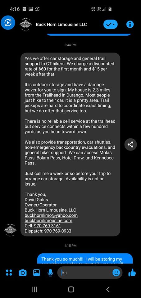
- Buckhorn Limousine Carl Geer at Backpackinglight.com reports “… run by a friend of mine and he offers, despite the name, really inexpensive shuttles to and from any destination in the southwest. He knows his stuff and spends thirty plus days backpacking in the Weminuche and the San Juans every Summer. Call this number 970-769-0933 and tell them Carl sent you. He can transport up to 7 people with gear at a time in a super clean new suburban. Visit his website at www.buckhornlimousine.com
- Western Slope Rides “Ground transportation between regional airports, including Telluride, Montrose, Ridgway, Ouray and Silverton. Plus gear transport and shuttle service to trailheads and other backcountry destinations through out Western Colorado’s San Juan Mountains.” https://gowsr.com/
- Gunnison Valley Rural Transportation Authority: In brief, this bus line makes it easier to get from Denver (and DIA) to such places along or near The Colorado Trail (within hitching distance) such Poncha Springs. Salida, Jefferson and Buena Vista. With this bus line, you can mix and match flying, local transit (RTD) and train to get to more places for hiking in CO. https://www.gunnisonvalleyrta.com/
- See also Mountain Valley Transit. https://mountainvalleytransit.com/
- The Colorado Trail Foundation shuttle list: Shuttles are probably your best bet as a Colorado Trail section hiker. The CTF has confirmed they do keep a shuttle list. Primarily people who wish to help but do not want their information posted publically online.
- Online Forums: Reddit and The Colorado Trail Facebook groups have been known to have people volunteer to shuttle as well. See the Other Resources section for information on accessing these forums.
-
-
Finally, if you are section hiking, The Colorado Trail Guidebook is very useful for trailhead info and directions.
Hiking The Colorado Trail with a Dog
-
-
- Though written for the Pacific Crest Trail, this document from the PCTA is handy and worth reading for general information.
- Dogs are allowed on the majority of The Colorado Trail. Be sure to follow leash laws and be respectful of your fellow hikers and wildlife.
- For The Colorado Trail specifically, the only place where dogs are not allowed is the stretch of trail in Waterton Canyon.
- The Thru-Hiker Facebook Group for dogs is also a valuable resource.
-
Take the Indian Creek Equestrian Trail located on Hwy 67 approx 10 miles from the small town of Sedalia. Follow this trail approx 6 miles to connect to The Colorado Trail at mile mark 8.8 at Bear Creek.Directions to this alt route are as follows fromTo reach this area, take U.S. Highway 85 south to Sedalia then take Highway 67 to the junction with Rampart Range Road. To access all the following sites turn left on to Rampart Range Road, this is a dirt road that is heavily traveled; please abide by posted speed limits.Map provided of this area by The Colorado Trail Foundation:Naturally, getting to and from this area will require more than the standard logistics. You may have to find a willing friend in the area or contact a shuttle service. Still, for a person hoping to hike with a dog on the CT, it provides a good option.
Other Resources for The Colorado Trail
Here are some other resources about The Colorado Trail:
-
-
- The Colorado Trail Foundation: The first place to stop for info on The Colorado Trail www.coloradotrail.org
- The CTF also maintains an active Facebook page. Excellent resource for current trail conditions, closures and other important information. Updated frequently.
- Mirroring other popular trails, Facebook pages for the current year hikers are cropping up. The Facebook pages are the most active discussion groups. Hikers of previous years had one, for example: “Class of 2021” or “Class of 2022.” Presumably, 20xx will have their own pages, too. Section hiking? Check out this Facebook page for CT Section Hikers.
- If you are a female hiker, be sure to check out the Women of The Colorado Trail group on Facebook. From the administrator of the group: FOR WOMEN ONLY. Gals, please check out a new Facebook group for female CT’ers. It has been created as a comfortable space for women to discuss their upcoming CT trips, whether thru-hike, section hike, or day hikes – in a positive, friendly, and non-judgmental environment.
- Reddit has an increasingly well-used discussion group.
- A PowerPoint-like presentation I did on The Colorado Trail is posted here.
- Dean Krakel wrote an excellent series for the Denver Post called The Long Haul: On The Colorado Trail.
- David Fanning has an interesting series of interviews with CT hikers called Voices of The Colorado Trail. Please read it to get a flavor of the people traveling on the trail.
-
Once you have completed The Colorado Trail, be sure to fill out The Colorado Trail Completers form. The CTF will mail you a rather nice-looking certificate to add to your mementos from your CT hike.
If you have additional questions or about this document or The Colorado Trail in general, please feel free to e-mail me. New info and feedback are always welcome, too! Please try to include COLORADO TRAIL in the subject line or the text. Makes it easier to filter my mail. Thanks!
Best of luck on your Colorado Trail journey!
—Paul “Mags” Magnanti
A huge thanks to the many people who contributed to this article over the decades!
Finally, a very big thanks to the many volunteers at The Colorado Trail Foundation who make this fine trail possible!
Colorado Trail “End to End” Guide – first version June 2005
Last Revised: November 2025
mags,
thanks for the forward on the c.t. trail. have a good summer and will look
for your forwards and e mails. i just might make it out that way this summer.
cutty taylor
Good update Mags. Don’t know if this is the kind of info you want to include but in Creede, there are other shuttlers. The owner of San Juan Sports offers rides to the Trailhead up that 4WD road and there’s a woman named Debbie who shuttles to Spring Creek Pass. San Luis Pass to Spring Creek Pass makes a good slackpack for those so inclined (we did).
Thanks for the info! Do you happen to know how someone can get in touch with Debbie?
Sorry for the late response – I didn’t get any prompt so I guess I have to check the site. I didn’t call her myself to arrange the shuttle so I don’t have her number. But I think the folks at the motel know her. In fact, it’s a small town – everyone knows her!
Not sure if this should be posted, but Debbie always answers and is friendly to help. Her number is 719-850-8715
Molas Lake Campground: Check this link under FAQ — updates on resupply.
http://www.molaslake.com/
Thx! Will update as appropriate!
greetings Pmags! I found your End to End guide very informative. Thank you for all your hard work. I wanted to pass along some trail talk. The hitch into Lake City is becoming easier and easier, and is not as hard as the guide imples. The locals are much more aware of hikers than before. I have met at least 10 hikers this summer who waited less than 10 minutes on Spring Creek Pass before someone swooped them up, including me. Not saying that Creede is a bad place, just that hanging out with other trail alumni is a pretty… Read more »
Thx for the info!
Just got an email from the folks at the store in Jefferson, CO. They claim that the Post Office was shut down due to cut back, but you can still send resupply boxes to them. Recommend using UPS or FedEx.
Swagman
Many thx for the info! I’ll update it now.
Hey,
I really enjoyed reading this, full of good information. I’m actually planning a trip doing the Collegiate Peaks Loop this summer from June 12th-22nd but I was wondering what your thoughts on that timing is. I feel like its right on the edge of being too early, but I think it could be doable pending the weather in May. I messaged the Colorado Trail Foundation on facebook and they told me it’d be too early by a month, but I definitely can’t push it back that far due to other engagements. Any thoughts?
For the Collegiates, that is unfortunately on the early side, esp in a “normal” snow year like we are having so far. The lower (Eastern) route may be OK for the most part, but even that will have a good amount of snow in spots. The western portion that hugs the divide? Very snowy. It it will be full of what we call rotten snow: hard in parts, full of dirt and ice, easy to post hole through, not consistent enough for snowshoes or skis. And the really high areas? Well, I go skiing on Mt Toll (13k) at the… Read more »
FOLLOW-UP: It is now May 12th. It is snowing in Boulder.
🙂
Hello, Swagman here again. What are the laws concerning hitch hiking in Colorado and what is the general attitude of the local authorities if they encounter a hiker hitch hiking? My experience on the AT is mixed. In Georgia the police have been known to give lifts to hikers. In New York and Connecticut they’ll arrest you on the spot if you even look like you’re going to stick your thumb out. One solution many of us have found is to make a sign (Need ride to town or ride to trail) out of some cardboard scrap or, this is… Read more »
Gotta say this is spot on:
http://hitchwiki.org/en/Colorado
Basically, anywhere unless the town forbids it and some federal exceptions (the interstate).
In general, esp in outdoorsy areas, you should have no trouble finding a hitch. People in Colorado are generally aware of the CT now and are happy to help. Even Spring Creek pass is an easier hitch due to increased awareness of the trail.
Hey Mags, great stuff love all the updated CW route info. I was curious if i was reading the info right. Is the monarch crest store right on the CW route or the standard route. I am trying my best to avoid hitching to town and this like Twin Lakes would be an awesome way of doing that. Thanks in advance
Yep. Right at the ski area. Get some ice cream when you are there. 🙂
Hi Mags,
Thanks so much for the great info! I bought the CT Map Book and it just seems terrible for actual navigation (especially if you get off the trail!). I’m planning on going with the Trails Illustrated Maps and am planning to do Collegiate West instead of East for the thru-hike. Can I eliminate any of the maps on your list? I checked out the TI website but I just can’t tell from their map whether I can leave any off. Thanks!
-Lauren
Hmm..not really since the CDT/Collegiate West route is simply higher and above the Collegiate West route. Another alternative so you do not have to carry as many maps are the Latitude 40 map series. Good enough to navigate on trail with alt bail out points. he Latitude 40 Maps aren’t as detailed as other maps, but cover a wider area. The new maps for the Collegiates (Buena Vista and Salida) are confirmed to cover the new Collegiate West route as well. http://www.latitude40maps.com/category/our-maps/colorado-maps/ Basically mix and match the TI and Latitude 40 maps. 🙂 The Summit County, Salida/BV and Durango maps… Read more »
This is fantastic! What a wonderful resource. We’re planning on hiking 100 miles of the trail so this was super helpful. In your experience is it safe to hike through the summer storms? We’ll be hiking from July 19-24th and know we will encounter storms daily. If we push for miles in the morning is it usually safe to continue hiking at a slower pace through the lightning or should we consider stopping for the storm to pass? Here in MN we hike right on through the lake effect rain that is usually heavier than CO storms but we don’t… Read more »
I’d start early and wait out the storms; preferably below treeline. Being exposed in a lightning storm is scary. 🙂
Hi Paul, First of all – thank you so very much for posting this helpful online guide! I am planning a long summer hike in the US and am contemplating between two “finalists”: Tahoe to Whitney (southbound via PCT & JMT) and Colorado Trail I have a specific question about… bears 🙂 (being an Israeli, I am at the same time excited about seeing one in the wilds and quite worried about the encounter…). You have stated that a bear vault is an “overkill” and that the bears of Colorado are not as aggressive as those of California (I hope… Read more »
Hi Inbar! Hope you enjoy your time in the States. One of my good friends is from Israel..I know he LOVED Colorado. 🙂
In areas with trees, hanging is suggested. If you think you are going to camp without trees, be sure to cook first, eat dinner and then move on about 1-2 KM and then camp. Another option that may work is the Ursack http://www.ursack.com/the-shop/
The bears in Colorado tend to be less of a problem than California, but you’ll want to use the above suggestions in any case.
Thanks Paul!
Will take into account the above and will read more about the issue of bears; if I still am not sure – I will go with the bear vault (regardless of its weight). Would rather be on the safe side… and also feel secure.
Will come back to show-off if I do end up thru-hiking it 😉
Best regards,
Inbar O.
Thanks for this great information. Just starting planning. Feeling keen!
Thank you so much for this info!! It is so hard to find good info on the long trails about dogs and where water supply would be. Me and my good friend are hiking thru with my three dogs and his one. Don’t worry I’m a trainer and have a lot of knowledge on dogs and dog behavior. No worries we know not all hikers want dogs around so we will make sure to not trail to close to ppl unless they ask to hang with the pack lol once again thank you for this great info on we we… Read more »
Thanks for the guide! Its very extensive and I cant wait to go next summer! I am using this a training run for the PCT. I’ve been backpacking since for about 8 years now but ive never been out for more than 7 days. Do you have any advice for someone about to transition to thru hiking? Thank you!
You probably have an excellent ccardio base, but it is a different set of muscles. Keep your base pack weight low and get out there hike/backpack as much as possible. Besides developing the fitness needed to walk all day with a pack, you’ll disk in your gear system and, best of all, have fun. 🙂 these links may help:
https://pmags.com/lightweight-backpacking-101
https://pmags.com/backpacking-a-beginners-primer
Hi Paul –
Great website, lots of very useful info (thanks).
Would you say Erik the Black’s pocket atlas is enough for a thru-hike? What about the Data book – is that enough or would one need the whole Guide?
Also, do you know anything about the quality of these maps:
http://www.barnesandnoble.com/w/colorado-trail-pocket-map-k-scott-parks/1108036789?r=1&ean=9781468029055&kpid=9781468029055&cm_mmc=GooglePLA-_-Book_Under5-_-Q000000633-_-9781468029055
Thanks again
Thanks for the kind words. ETB pocket atlas is essentially a map guide and town guide in one. Probably would work. They are CT corridor maps and do not show much outside the trail corridor. May or may not be an issue for you. The Postholer maps are high quality but are corridor maps as well. Similar to the Bear Creek Maps. I’d take the databook for on trail and leave the guidebook at home for reference. But that is just my preference. If I was to hike the CT again, I’d take the databook, the Lat 40 maps (do… Read more »
Paul: Thank you for posting information on the CO Trail. Any suggestions for where to leave in Durango at or near the trailhead- or what business to contact in Durango to get info on where to leave a vehicle?
For longer term parking, the tourist train does allow per the day parking:
http://www.durangotrain.com/dsng-parking#.VcAovehViko
The airport has longer term parking is a little less expensive
http://www.durangogov.org/index.aspx?NID=206
Finally, the Durango Chamber of Commerce may have some other places not readily apparent http://www.durangobusiness.org/
FYI, Frontier Airlines no longer flies out of Durango.
Used some of your tips on the trail. We had a blast. We live just 5 miles from the Dgo TH so we literally waked home. Of course we wanted to just resupply and keep going until we ran out of money!
Thx for the info. Glad you enjoyed the trip! I plan on updating this doc early next month.
Thanks for the incredibly thorough post about the Colorado Trail. I’m about a quarter of the way through it as of 2015. I started doing it a hiking trail but have now joined up w/ a mountain bike group and am doing as much of it as possible on bicycle. Either way, it’s a great trail.
I also enjoyed working on a segment 8 volunteer trail crew this past summer. I figured that if I’m going to be using the trail, I should also volunteer to help maintain it. What a great experience. Hard work, but lots of fun too.
I agree. Volunteering is an excellent way to give back…and, if hard work, can be fun too!
Mags…
Thx for all the great CT info! Any recs on getting to twin lakes or other TH to do the collegiate loop in July. I plan to bring my trail dog and 10 year old which complicates logistics as the busses don’t allow dogs…only option I’ve found so far is a one way rental from Denver to Leadville and repeat to return. Had a blast last sept on JMT can’t wait to get high again! I live at sea level!!!
Thoughts
Salty
Hmm..not overly familiar with dog transport options. Maybe call The Colorado Trial Foundation and see if a private person is willing to do a shuttle with your dog?
Hi Mags, do you know what possible re-locations have occurred on the CT since October 2012? From what I gather, the collegiate CDT loop is the newest thing added since then. I hiked to Buena Vista in 2012 from Denver. Probably will go out there again this summer and hike to Salida from Denver. I have the 8th edition CT guidebook and the CT data book. Are theer any addendums I need to brush up on?
The collegiate west is the major change. I would get the latest data book as it will have the changes in detail.
Awesome! Thanks for posting this and making it completely free and available. You rock 🙂
This guide is an incredible resource! Thank you so much.
I would like to point out a small error in your Salida description though. Poncha Springs is actually 5 miles west of Salida, not 10 miles east. This is probably not a big deal for most folks, but you never know.
Thanks again for this guide Mr Mags.
Thanks for the kind words. Thanks for pointing out the error. It is 10 MINUTES by driving…doh! 🙂
Aloha,
Is it possible to email the resupply chart.
The last column is cut off from view.
Thanks
That’s only an issue on phones from what i have seen. If you use the save to pdf option at the very start of the document, you will have the info you need.
Thank you.
Was using a phone, and was able to dl. Pdf
I appreciate all the time&energy you put out there for the world!
My pleasure. It is a labor of love and good to give back to something I love. 🙂
Thank you for the great information. I am looking for a breathtaking experience to take my sullen teenager on. I am looking for a week long trek, camping along the way, hoping to engage him with the joys of outdoors vs. video games. What section would you recommend? He has never done a hike like this before, and it has been about 15 years for me, however we are both in great shape and love to climb. Thank you again,
I’d do the Collegiate West option. Roughly 80 miles, easy logistics, you can resuspply along the way and there is great scenery. Not sure what elevation you are used to, but an acclimation day or two is strongly suggested if you have the time.
Hello! This is wondrous information. My sister and I are looking for some advice for our CT hike in august. We have 2 weeks, and we are trying to determine which portion of the trail will work best logistically. We are coming from Canada, and neither of us drive, and we’re broke so we’re hoping for bus. We’re two ladies who don’t object to hitching, but also really want to be safe… Our guidebook is designed for Denver- Durango direction, so we’ll probably stick with that. Our understanding is the CT half going into Durango is most spectacular, but it… Read more »
I’d use some of the shuttle information listed to plan a section hike further down the trail from Salida. Enjoy the journey.
Mags Im starting the collegiate loop Saturday out of Twin Lakes. Trying to finish in 9-10 days so trying to keep my food haul light. So far I plan to drop a resupply box at Monarch Crest and MPHS. I’ll be hiking clockwise so this leaves the heaviest food haul on the most difficult section(west). I’m concidering a food cache at Cottonwood pass. I have a camo 4″x 3′ pic cylinder I turned into a sealed container w end caps and lined with odor barrier bag….I’m thinking about hiding this near cotton wood pass..thoughts…I plan to go back for it… Read more »
A cache could work..but I would not use something that is not bear resistant personally. Consider an ammobox instead: Inexpensive, used in NPS units for bear proofing and was used successfully by other CT hikers. https://pmags.com/quick-tip-ammo-boxes-for-caching
I don’t know if you want to include this in part of your guide, but I found a decent online map of the trail with the segments and CW route outlined:
http://www.colorado.aaa.com/wp-content/uploads/colo_trail_map.jpg
I am planning a CT hike and hopefully will include a CW loop in it. Visualizing the trail and resupply points, etc., is difficult with the piecemeal maps that I have in my official CT guidebook and data book. Maybe others can find it useful to have the whole CT displayed in a jpeg.
Thanks. That is The CTF map from their website. Probably not a bad map to include, though.
Does the Guthook guide (I purchased the full trail) contain the same details as the databook?
I ask because I am planning a week on the trail and want to map out where I plan to camp. When looking at the app, it appears there is a campsite after crossing over Bear Creek (mile 8.9), but no other sites for another 20+ miles. I need to see all campsites. Is this included in the data book, or is there a better way to find this info?
Thanks for your help!
John
No app or databook will list *all* the campsites. Unlike the AT with its shelter system, the CT is mainly dispersed camping. There are popular spots listed in the databook and apps, but no resource to list every possible camp site. Map reading for overall lay of the land combined micro reading of the immediate topography is the best bet. This article may help as well.
Also, I’d ping Guthook for the details on the databook vs the app. He’s very responsive and gives excellent feedback. Good guy!
Hey Paul, thanks so much for putting together this guide! Seriously so helpful, as a prep for the CT this summer. One question for you – how are mosquitoes along the trail? I am used to a lot hiking in Oregon, but was wondering if the high altitude might lead to fewer? Or maybe I am just dreaming… anyways I will be starting in mid July
Near water and lower elevations will be noticeable esp at the start of the summer. Higher elevations and at night, not so much. At least that is how it is for me. Colorado is much drier than Oregon of course. Happy Trails!
Perfect, thanks so much!!
Hey Paul,
Just wanted to let you know, I just got off the phone with Mt. Princeton hot springs and although they are right off the trail, the woman assured me they offer nothing cheaper than 230 a night.
As a side note, thanks so much for making this guide, it has been a ton of help!
Noted and updated. Thanks!
I’m planning to hike from Molas Pass to Junction Creek. I understand there’s parking at the Junction Creek TH – I assume I can park a car there for a week or so? Or is it likely to be full in mid July?
Goat
You should be able to park there for a week. I’d let the local USFS know first. If you go on a weekday, availability is, of course, going to be higher.
any tips for transport to and from trail with a bike. starting Denver Centre and to get back to denver centre? thanks, D, UK
I’m more of a backpacker than a bicyclist. May want to contact The Colorado Trail Foundation and see if they have some resources that may be useful for bikers.
Hi,
I appreciated your article post. I like your article post and it’s very useful blog.
many thanks for sharing us
Hi,
It’s very beneficial blog. I like your blog.
thank you for sharing us
my god man, this guide is fantastic! well done!
[…] https://pmags.com – End-to-End-Guide von Paul Magnanti […]
[…] https://pmags.com – End-to-End-Guide von Paul Magnanti […]
[…] https://pmags.com – End-to-End-Guide von Paul Magnanti […]
I appreciated your ‘End to End’ guide, and used it to help me “thru” the CT in 2018.
I tallied my own “on-trail” expenses (total from DIA airport to DUR airport) at slightly more than $800; so I think your figure is pretty accurate.
I mostly prepared my own meals in the hostel kitchens (which are pretty well-equipped) to help me contain expenses. Also enjoyed the camaraderie with the other hikers there that were doing the same.
Paul, You mention that Amtrak stops in Frisco. Did you actually mean Frasier?
Nope..but kinda confusing. Amtrak runs a bus stop there to connect train routes (as they do in other areas). https://www.amtrak.com/thruway-connecting-services-multiply-your-travel-destinations
They have a thru-way bus stop in Frisco.
https://www.predci.com/train-bus-stations/Summit-county-CO/hours-phone.html
EDIT: I updated the entry for clarification. I apologize for any confusion.
[…] of this portion of the planning, I was lucky to stumble upon a few very helpful resources including The Colorado Trail “End to End” Guide and Colorado Trail Thru-Hiking Itineraries. I cannot begin to express how thankful I am to have […]
Hey, I clicked on the Biivi hostel link, the prices look to have gone up. Looking at my expected dates in August it’s $35 including the discount ($39 without). For tomorrow (last-minute-ish), it’s $44 ($49 without). Just FYI.
Heading to Moab for a visit this winter, loved reading your articles and can’t wait to check it out!
Yep. Prices do change. Thx!
Hello Paul, Great info and thanks a million for all your efforts. Keep up the good work! Does anyone offer a supply drop/rendezvous at Colorado 114, mile marker 303.2 from Denver nowadays? Seem to recall someone in the past would either be there or leave your resupply at the trailhead of Colorado 114. Would appreciate any info and again thanks for everything. Stickman
[…] hikers. There are other guides that provide information also – Yogi’s Town Guides, Pmags End to End Guides, […]
Hi Paul,
This website is such an amazing resource! Thanks for putting it together.
Is there a popular detour to Telluride? Quickly looking at the Colorado Trail map, the trail swings south towards Durango before getting to Telluride. I’d love to detour off the CT and stop in Telluride on the way to Durango. Know of anywhere that talks about doing a Telluride detour or is the terrain not really conducive for a detour? Thanks!
My pleasure, David!
I can’t think of one off-hand, but there are enough network of trails/jeep roads in that area where you could probably put together something. Could be an an “in and out”, or something that gets off the CT and then reconnects if you are not too concerned about “purity” (I tend to not care about that concept myself! :D) It will be a bit off the beaten path, however.
[…] foods I want while not spending valuable time trying to figure out options at a grocery store. The End to End Colorado Trail guide assists in this kind of planning. […]
[…] foods I want while not spending valuable time trying to figure out options at a grocery store. The End to End Colorado Trail guide assists in this kind of planning. […]
I’ve never hiked the CT, but am planning a 1 week trip. Like views and peaks (can manage 15 miles/day fairly comfortably). What sections would you recommend I choose to hike?
I’d pick up the official Colorado Trail Guidebook by the CTF and see what looks good for you based on logistics, elevation gain, and preference. Perfect for the question you are asking. The San Juan sections, overall, end up as the most scenic. Have fun!
Silverton Hardware would like to update our through hiker information from above. We are no longer able to accept USPS or Fed-Ex packages as we are now an official UPS access point. Also, all packages shipped to our 740 Greene St Silverton CO 71433 address via UPS must be picked up within 7 days or we have to return them to UPS. This is out of our control now, as an access point. We are, however, stocking more fuel, freeze-dried food, meal bars, electrolytes, and first aid than we have ever carried in the past for hikers. Our phone number… Read more »
Thank you Dana and Jerry. Appreciate the updates.
[…] like whereas not spending useful time attempting to determine choices at a grocery retailer. The End to End Colorado Trail guide assists on this form of planning. […]
[…] https://pmags.com/colorado-trail-end-to-end-guide-2 […]