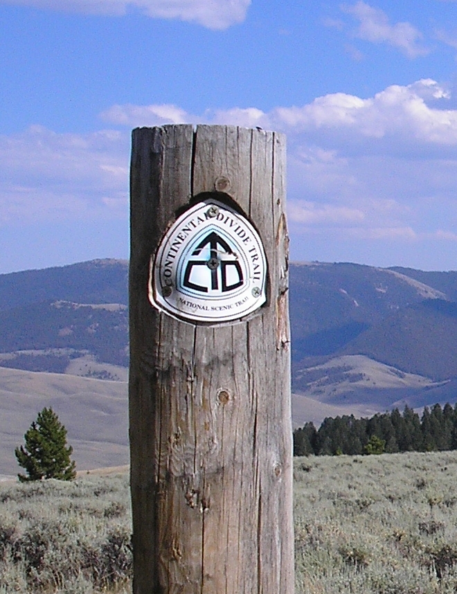
The Continental Divide Trail is the last of the “Big Three” trails that most thru-hikers tackle as part of the Triple Crown of long-distance hiking. Raw, wild, remote and unfinished; it is a trail that will make use of all the skills of an experienced backpacker. It is also a trail that is beautiful, stunning and perhaps the most rewarding of the major long-distance hiking trails.
This handout will help you prepare for the basics of a journey for this trail. It is not meant to be an exhaustive document. As always, you should consult with other resources before heading out on an extended trek in the mountains.
Updated Feb 2023
The Continental Divide Trail at a glance
- Administered by US Forest Service
- Currently, 95% of the trail is on public land.
- Many alternate routes
- The trail is a mixture of defined trail, dirt and paved road walking. Most cross-country travel is on alt. routes vs. the designated trail.
- There is a designated route partially in place by the USFS, but most people take alternate routes in places
- The CDT mileage estimates range from a minimum of 2500 miles (using guidebooks and maps that are reported to be off) to a high of 3100 miles. Most people believe the standard route is ~2600-2700 miles with 2800 miles splitting the difference. Yeah, confusing. Either way, it is a long freakin’ walk. 🙂
- Goes through Montana, Idaho, Wyoming, Colorado, and New Mexico along the spine of the Rockies (more or less)
- The northern terminus is in Glacier National Park and ends at the Mexican border. Three southern termini: 1) Columbus, NM 2) Antelope Wells, NM or the 3)Crazy Cook Monument. Note the CDTC now offers shuttle services for Crazy Cook.
Appalachian Trail vs. Pacific Crest Trail vs. Continental Divide Trail
- Needless to say, the AT and the CDT are not alike in any way. They are both long trails that go through the mountains… and that is where the similarity ends
- A better comparison is between the CDT and the PCT
- Both are about the same length, go above treeline and in remote areas
- As with the PCT, the CDT is open to horses. Currently, parts of the CDT are also mountain bike accessible
- The PCT is finished, is well marked and is relatively well used. The CDT is unfinished, is not well marked in many places and is very unused in places
- Take most thru-hikers 4-5 months to hike the CDT
- Logistics are similar to the PCT; about 5-7 days in between resupplies
- Fewer towns than the PCT (never mind the AT); the towns stops do tend to be more expensive (fewer hostels vs. motels, fewer trail angels and so on). Call it a wash.
- ~$1200/month to hike the CDT once on trail
- A NoBo will start in late April and typically finish in September. Start too early, and you hit much snow in the San Juans of Colorado. End too late, and you hit snow in Montana
- A SoBo will begin in mid-June and typically finish in November. Start too early, and you will see much snow in Montana. Dawdle too much, and you may hit snow in the San Juans.
Two Trail Philosophies
There are two trail philosophies for the CDT: The designated route put forth by the USFS and more of a corridor approach taken by many CDT hikers. I used to say that the concept of purity on the CDT is nearly non-existent. Often a choice of routes is made due to weather, desire for resupply, fires, trail closures, floods, wanting to see certain highlights or “just because.”
However, due to a multitude of resources now available regarding maps, GPS tracks, additional trail markings and so on, more people are *attempting* the designated USFS route vs. previous years.
So now more people are attempting to hike the Continental Divide National Scenic Trail vs. the Continental Divide Trail.
The CDNST is the designated trail put in place by the USFS. For those who prefer a more defined trail experience, hiking the CDNST holds a lot of appeal. The designated trail goes through some amazing places and will not be a disappointment.
Other hikers are hiking the CDT. Sometimes it coincides with the CDNST; other times it does not. Sometimes the CDT is more remote and more difficult than the CDNST. The beauty of the CDT can rival or even surpass the designated CDNST in places. In other locations, the CDT is sometimes shorter, sometimes easier, a little less scenic and sometimes more straightforward than the designated route.
Or, to put it succinctly: There is one designated CDNST; there are many variations of the CDT.
Which route is better?
That’s a silly question. You just have to decide for yourself. 😉
And so it goes.
Trail Organizations
The Continental Divide Trail Coalition is currently the leading advocacy group for the CDT. The CDTC, to quote its website, is a coalition that “connects the community that supports the Continental Divide National Scenic Trail” Their Facebook site says it quite nicely, too “We connect the community to protect, preserve and promote the Continental Divide National Scenic Trail“. The CDTC works directly with government agencies, outdoor groups and communities to help protect the trail and helps provide a strong voice for the CDT community.
The Continental Divide Trail Society is older and no longer active. It was started by Jim Wolf. The CDTS typically defined a route that may be a bit more off the beaten path. The CDTS produced some guidebooks that are not used as often. The CDTS is now formally working with the CDTC.
And there are many other organizations that promote and protect the CDT, build the trail, organize fundraisers, lobby with the government, and so on. Fittingly for the CDT, there is a broad range of groups and people with different ideas and methods who all love the trail and the community around it. The CDTC helps act as a larger umbrella group for the CDT overall and does a fantastic job to help herd cats.
Primary Concerns of CDT hikers
Most aspiring thru-hikers of the CDT have a few key concerns. A CDT hiker should have considerable backpacking experience and ideally have done a previous long hike on a Western trail such as the PCT. The CDT is *NOT* a beginner’s thru-hiking trail. It is assumed that an aspiring thru-hiker should know how to read a map, use a compass, and manage resupplies and water issues. Having said that, the major concerns for most thru-hikers seem to be:
1) Navigation
The CDT is a work in progress. It is not a well-marked trail like the PCT, never mind the AT! A CDTer should know how to use a map and compass. Though the trail gets more defined with each passing year and in places such as Colorado the trail corridor does not pose any major navigational challenges.
Though not needed, a GPS or, a GPS-enabled device such as a smartphone, is found to be useful for many hikers. The GPS helps with what I politely call the WTF (Where The BLEEP) factor. A GPS will pinpoint your exact position on the map. Many GPS units also have software that allows to you load in maps. A GPS does have limitations, though and it is not a replacement for map and compass and knowledge of their use.
Note that in recent years, a smartphone has replaced a dedicated GPS unit in much the same way a smartphone has replaced point-and-shoot cameras for many people. See below for CDT GPS-based apps for smart devices.
This navigation series by the Columbia River Orientation Club is very nice! They cover smartphone navigation, too.
2) Maps
A thru-hike of the CDT needs LOTS of maps. Almost all thru-hikers use the Jonathan Ley maps (JLey). These maps show several routes for the CDT and have made hiking the CDT less daunting. A CD with the maps can be procured from http://www.phlumf.com/travels/cdt/cdtmaps.shtml Note that these maps may be printed with a purchase of Yogi’s book as well (see below). As of 2016, the JLey maps may be used with the popular Avenza Maps app for smart devices.
As great as the Ley maps are, they are limited. They do not give the broad view sometimes need for taking alternate routes (such as when a fire occurs and/or a major snowstorm happens. Both incidents happened to me!)
As of January 2018, the CDTC now has a free CDNST map set and planning guide to download as well. Works with the same Avenza app as the JLey maps.
Some alternate maps in brief are:
Delorme Gazetteers – The Gazetteers give a large overview of the area where the trail goes through. Useful for finding out USFS roads, alternate routes and/or bail out points that smart devices and print maps may not have listed. You may want to trace/draw in your CDT route based on Ley Maps or other resources
Trails Illustrated Maps – For Colorado and Glacier National Park, these maps show the CDT routes in excellent detail. A little expensive (~$17 ea.) and heavy, but they can make navigation easier esp. if you need to take alternate routes from your planned itinerary. Not used by those following the more popular routes or alternates. If you want to bag Colorado 14ers however, a good choice.
Earthwalk Press Wind River Range Maps: Some more adventurous CDT hikers take their own routes in Winds. The J Ley maps show some great routes. The Earthwalk maps can also help make your route through this fantastic area.
3) Guidebooks and databooks
Very few people take dedicated trail guidebooks anymore.
There are two options, one of which is no longer in print.
The Continental Divide Trail Alliance published guidebooks that are aimed more the weekend or short distance backpacker. They provide trail access info, colorful pictures, and trivia. They are of limited use for the long-distance hiker, however. They are nearly two-decades old and best thought as reference material from the past.
The Continental Divide Trail Society puts out guidebooks as well. Popularly known as the “Wolf Guides,” the books by Jim Wolf are very descriptive and accurate. They show the CDTS and not necessarily the designated USFS route in some cases. They are not as widely used in previous years, if at all, and are increasingly hard to find.
Additionally, these resources are available…
Postholer has a CDT databook and profile maps avail as well. Same data as Scott’s very good CDT planner. Postholer also has a neat little, and free, databook app that also has the weather and makes it easy to post journal entries on the Postholer site. For Android only at this time.
FarOut (Guthook’s) CDT App From the makers of the well-known PCT and AT apps, these apps for the Android and iOS platforms make use of Bear Creek’s maps along with trail information from users. Reports are very good. As always, I would not rely 100% on any electronic guide. YMMV.
Offline Maps:Offline Maps done by Noam Gal for the AT, PCT and CDT that makes use of the Backcountry Navigator app.
The CDTC has a free CDT Planning Guide “The CDT planning guide is a one stop resource for starting to plan your trip along the CDT. From which direction to travel, navigation and safety resources and a comprehensive resupply chart this guide provides a solid foundation for planning a CDT trip.”
Guide and Map Confusion?
Not sure what to take? Here’s a summary of the popular resources many people use.
The ‘official’ guides are way out of date and haven’t been updated in almost 20 years or more. They are also from an org that no longer exists. The Wolf books are available for those who like a traditional guidebook but aren’t as popular at this point and not updated.
In brief, the popular resources are:
- The Far Out Guides (Guthook) app has a lot of information consolidated in electronic form and makes navigation much easier. Many notes from hikers
- The CDTC Map set and planning guide available for download, printing, and smartphone use is, of course, very useful
- The J Ley maps show alt routes and the official route (if not as good detail as the above maps and guidebooks), Many annotations from previous hikers on the maps. As of 2016, the popular Avenza PDF Maps app may be used with the J Ley maps for smart device use.
- Then there is Yogi’s guide aimed more at town and logistic info
- Larger overview maps of some sort, such as a backcountry road atlas, are still suggested by a fair amount for bailing purposes or alternate routes when needed.
Most people take a mix of the above. The Grand Unification of CDT guides is still being sought. 😉
4)Resupplying
The challenges of re-supply are about as difficult as the PCT. About 5-7 days between re-supply. If you are not overly picky, you can re-supply just about anywhere. The hybrid approach (buy groceries in a large town and ship out to a smaller town) works well, too.
Also, new commercial enterprises are mailing out food, gear, and other sundries to hikers. Quite a few may be found via a Google search such as, but not limited to, Trail Supply Co, Outdoor Herbivore, Zero Day Resupply, and Sonora Pass Resupply. They regularly post on forums and Facebook advertising their services. Some hikers are using Amazon Pantry Service or the Walmart equivalent, too.
This link will assist in printing out mailing labels for stops along the CDT: http://www.soruck.net/cdt/
5)Grizzly and Black Bears
In Glacier, the Bob Marshall Wilderness, and Yellowstone, grizzlies roam. You are not at top of the food chain! Luckily, grizzly bears will not bother you for the most part . In Glacier and Yellowstone, bear poles are set up for your use. In “The Bob”, you’ll want to use normal precautions for bear country. Because hunting is allowed in “The Bob”, bears tend to be wary of humans.
Some hiker take bear spray as a precaution. Whether you take bear spray or not is an individual decision.
Personally, where allowed, I think the Ursack works best for those with bear and critter concerns. No hanging needed. Less bulky and lighter than a bear canister.
As for black bears, more places are requiring canisters regardless if grizzlies are present or not and I would not be surprised if more places require it in the coming years.
Rocky Mountain NP requires bear canisters currently.
When in Grand Lake, CO, you have three choices:
6)Water
In the Great Divide Basin of Wyoming and New Mexico, water can be scarce. But, again, no worse than parts of the PCT. Use your guidebooks and maps, the CDTC Water Report, pay attention, and you’ll be fine.
7)Snow Travel
In a heavy snow year and/or with an early start, an ice axe (and possibly crampons) may be needed in the San Juans if going northbound. If going southbound, an ice axe (and possibly crampons) may be needed for similar reasons if attempting the High Line trail in Glacier National Park. Please note that there are lower, if less scenic, alternatives for the high routes.
This link is useful for overall snowpack in the Western US. Should help with planning.
8)Northbound vs. Southbound vs. Flipping
There is no such thing as an easy hike of the CDT! When going NoBo, there may be a lot of snow in the San Juans and winter may come early to Montana. When going SoBo, you may run into too much snow in Glacier and winter can come early to the San Juans. In some years, as much as three feet of snow was dumped in the San Juans by mid-September. A good two weeks early! In other years? No major snowstorms have come to the Colorado Rockies even by November.
Every year is different.
Another option is to flip. My fellow Coloradoan Sidewinder chose to flip. He hiked up to Berthoud Pass near Winter Park, flipped up to Glacier, and hiked south to finish back at Berthoud Pass. He missed much of the snow the SoBos ran into in Fall 2006. The disadvantage of this method is that you lose the feel of a continuous journey.
9) Cost
Cost of a Thru-Hike
As mentioned, an average thru-hike costs about $1200 a month once on the trail as of 2022. The average price of rent, taking inflation into account, seems remarkably consistent with this figure over the years. If you take a longer hike, you will need more food, be out in the weather longer, probably incur more town costs and may need to replace more gear.
A good, rough equation for overall expenses is this idea:
COST OF GEAR TO START + TRANSPORTATION TO TRAIL + (MONTHS ON TRAIL * 1200) + TRANSPORTATION FROM TRAIL. = ROUGH COST ESTIMATE
The cost of your initial gear and transportation to and from the trail will differ from hiker to hiker. Do you already have the gear? Or is this your first long hike and buying all-new lightweight gear? Do you live in Denver with (relatively) easy and cheap transport up and down from either terminus or are you coming from Boston and need to get some expensive flights to and from each terminus (or a long ass bus ride!)
I feel pretty comfortable on the $1200/mo figure once on the trail. This figure includes food, town stops, and some typical gear replacements (shoes and socks come immediately to mind).
These figures are for a middle-of-the-road hike. People who want more luxurious accommodations vs hostels take side trips with car rentals (Hey! Let’s check out the brew pubs in the Colorado ski country for a few days and/or check out Boulder and Bozeman), expensive restaurant meals vs a burger and beer, etc. will spend more.
Though different, the Triple Crown trails end up having similar costs.
Other people do avoid some of these costs by having family members ship food/finance part of the hike, doing “work for stays” at some hostels (more common on the AT versus other trails), depending on hiker boxes or depending on the charity of others. “Jester” wrote a detailed account of his 2015 expenses as well which is perhaps more realistic. A more recent 2019 set of statistics shows ~$3500 for just over 4 months with almost all “nero” days. The yearly Halfway Anywhere shows similar prices for the PCT. Update for inflation, of course!
“Jester” poses some good questions to ask yourself as we’ll concerning a budget, too.
More thrifty hikers, esp those with experience and who know the CDT well and/or are disciplined, might be able to go more frugal at ~$800/mo. (And, as always, I am sure there are exceptions. ![]() )
)
Section Hiking the Continental Divide Trail
As the CDT is becoming more of a well-known trail, section hiking the trail is becoming a more popular option.
A thru-hike can be a wonderful journey. Something romantic about putting on a pack, and walking the length of the country on your own power, grit and resolve.
But, that is not an option for everyone. Financial obligations, family, job, etc. makes taking off ~5 months to walking a long trail difficult.
So, much like hiking on the Appalachian Trail, section hiking the Continental Divide Trail can be a viable option. Unlike the Appalachian Trail, section hiking the Continental Divide Trail is logistically more difficult. Most hikers who section hike the CDT, hike in larger chunks of 2 or 3 months each rather than say the 2-3 weeks of section hiking the AT. I’ve heard this method of larger blocks of time called “chunk hiking”.
The advantages of “chunk hiking” the CDT are as follows:
- Fire and flood closures are now an annual occurrence of the CDT. It is no longer IF a section is going to be closed due to fire or floods, but WHEN. (Sigh) Chunk hiking lets you avoid these closures a bit easier. Hike the sections when a fire is less likely to happen.
- Pick and choose the sections at optimal times. Glacier or the San Juans when the wildflowers are in full bloom? Fall in New Mexico? Good stuff!
- Less of a time crunch to “beat the snow”. A more leisurely hike can be had. Take that extra day off to see Logger Days in Darby!
- Do all those alternates you wanted to try out but could not see if on a tighter thru-hike schedule.
- Sure there are others, too…
There are more logistical challenges, but not as bad as it may seem if hiking larger chunks. For example, if you hike from Glacier NP to Rawlins, WY, there is public transit avail to get to Denver. Likewise, if you were to hike from Rawlins, WY to Cumbres Pass (Chama) you can take public transit to Santa Fe and then Albuquerque.
Thru-hiking the CDT has its own rewards, but so does chunk hiking. 🙂
Stoves and flame bans
Please see the guidebooks for places to pick up alcohol and canisters.
As an aside, land agencies are getting strict with the types of stoves being used in the increasingly fire-prone west. In brief, a stove without an on/off valve is often not allowed. No alcohol, no Esbit or campfires basically. Please see this doc I wrote earlier for more information. Please pay attention to the stove bans. Really.
Permits
There is no master permit such as the one for the Pacific Crest Trail. A backpacker needs to have a permit for each of the National Parks and certain wilderness areas.
Permits are required for Glacier National Park, the Blackfeet Nation land near East Glacier, Yellowstone National Park, Rocky Mountain National Park (if you choose that route), Indian Peaks Wilderness (if you choose the older CDTS route) and a self-signed permit for various wilderness areas.
Dogs
Though not as difficult in terms of logistics as the PCT concerning dogs due to legal reasons, there are similar challenges. The national parks do not allow dogs, and a kennel option or alternate route will need to be explored. Extremes in the environment also factor in.
Section-hiking with a dog and cherry-picking the sections may be easier for your dog overall.
An event sponsored by the CDTC at the start of the NoBo thru-hiking season and traditionally held in Silver City, NM each April.“Join us to explore the Continental Divide, its unique communities and cultures, and the wonderful, wacky world of long-distance hiking.” *** Check the events page for the 2024 event information.
Resources
Groups
Continental Divide Trail Coalition – http://www.continentaldividetrail.org An umbrella group to help organize the many supporters, trail orgs and such that help supports the CDT. More grass-roots-oriented than the former CDTA. The group is reaching out to all people and groups that love the CDT. The CDTC is now a full partner with the USFS, too.
ALDHA – East www.aldha.org Though primarily for Eastern hiking, there are many people in the organization who have also hiked the CDT
ALDHA – West http://www.aldhawest.org/ This org focuses on Western hiking and hands out the Triple Crowner awards
Discussion Boards/Lists
Facebook: Various “classes” typically have their own Facebook group (e.g. class of 2020 and class of 2021) and are sometimes valuable for answering questions and exchanging information. Being FB, the discussions can get ah..interesting at times… The main CDT page tends to be less contentious. Facebook, overall, tends to have the most discussion.
CDT Reddit forum: http://www.reddit.com/r/cdt Some activity on this sub-Reddit for the CDT.
On-line Resouces
SpiritEagle http://www.spiriteaglehome.com/cdt.html Jim and Ginny Owen have hiked the CDT twice and many other trails. Their THRU-HIKING papers are a must-read for any hiker on any trail in my opinion. The website is cached but still worth reading.
Postholer: www.postholer.com A site with journals, forums, a Google map and a regularly updated snow percentage level along the divide
Walking With Wired: http://www.walkingwithwired.com/p/cdt-2013.html Erin “Wired” Saver had some excellent info and resources for the CDT esp if hiking with electronics.
Hiker Box –http://theuncalculatedlife.blogspot.com/2015/12/cdt-thoughts-and-advice-for-future.html Some good advice and alternate route information for the CDT.
Guidebooks and Planning Guides
CDTS Guidebooks aka “The Wolf Guides” :The only overall trail guidebooks still in print.. Not as popular as they used to be.
CDTA Guidebooks Were meant more for a short weekend or so type adventure. Really not suggested for a long-distance hiker. Pretty pictures, though! As mentioned, these are a decade or more old and from a group that is now defunct.
Yogi’s CDT Handbook http://pcthandbook.com/ My good friend Yogi has put out a leaner version of her popular PCT handbook for the CDT. Great information, thoroughly researched and meant for the experienced long-distance hiker on the CDT. Very useful! (Full disclosure: I contributed to both the PCT and CDT handbooks. I receive no compensation other than satisfaction in helping out a friend in addition to fellow hikers).As of Dec 2014, Yogi and Bear Creek have a deal where both the maps and the book may be purchased together for a discounted price. Note Yogi has something similar for the J Ley maps, too.
Peanut Eater’s CDT spreadsheet: Valuable tool for planning your CDT hike. Save your own copy first otherwise the whole world will know your planning info. 🙂
Of course, planning for the hike can be exciting. But sometimes it is inspiring to read other hikers stories or online journals:
Books:
Where the Waters Divide by Karen Berger A good account of thru-hiking the CDT
Westcliffe “coffee table” CDT books Glorious pictures and good writing for each of the states the CDT passes through
Scraping Heaven by Cindy Ross A an account of a family section hiking (and biking) the CDT.
The Backbone of the World by Frank Clifford An excellent account of the land, the culture and the politics of where the CDT passes
The Journals of Lewis and Clark Vivid account of what it was like to travel along and on the divide without guidebooks, lightweight gear or a microbrew in sight. Call it deep background reading….
Videos:
The Walkumentary http://www.thewalkumentary.com/ A video done by my buddy Disco. A funny, heartfelt and true-to-life account of hiking SoBo on the CDT in 2006. The fact I’m in this video does not in any way make me give it a glowing review. 😉
Walking the Great Divide http://www.flaglerfilms.com/ Mark Flagler came out with a professional grade documentary about the CDT. It is not only about the thru-hiking community, but also about the trail and the land around the CDT. Mark has previously come out with Appalachian Impressions.
Embrace The Brutality by Shane “Jester” O’Donnell http://www.tbwproductions.com/ Embrace this comical and thoughtful look at hiking the CDT!
There are many CDT videos on YouTube; Homemade Wanderlust being the most popular.
Best of luck on your CDT journey! All thru-hikes demand an odd mixture of flexibility and stubbornness..more so on the CDT!
As my buddy d-low (CDT2005) likes to say about the CDT: “EMBRACE THE BRUTALITY!!!!” Embrace the challenges. Embrace the beauty. Embrace the wildness. Embrace all that is so great about the CDT!
If you have any additional questions about this document or the CDT in general, please feel free to e-mail me.
Nice summary…I’d say a GPS with CDT tracks (“Out of Orders”) or others is a HUGE asset..I was lost in much of Montana (with a mapped but trailess GPS) until I was enlightened…if you like to press on in uncertainty bull it out with map and compass
CDT-‘09,10;PCT ’07:AT’88,89
A GPS can be handy, but I don’t think it is absolutely needed. I was misplaced here and there..but never enough where I felt I absolutely needed the GPS. But I can be a cranky old school guy at times. 😉 If anything, I had more trouble in New Mexico with all those ranch roads!!! 🙂
Hi Paul, I’m a bit like you in that I love my topo maps! Considering not bringing any gps tech. Do you have a compass you would recommend? I carried a $20 one from REI on the PCT, but never used it. Thank you.
I’m a fan of simple compasses. Something like Silva Starter 1-2-3 or the Suunto A-10 wors well enough, aren’t expensive and less than ounce. If you’d rather have one with declination you can pre-set, the M3 by Suunto is a good one for only ~$30 or so.
In our first and a bit too early CDT section hike, in the San Pedro Peaks and Parks Wilderness, in New Mexico above Cuba, we lost the trail in the snow. We plowed, well actually postholed, our way on with our Ley map and compass. But we lost a day and a half and had to cut out the next part of the section hike as we no longer had enough time to complete it.
All of our next section hikes included a gps. My motto had become, “as a section hiker we don’t have enough time to get lost.”
Hey Mags! Great writeup. I’ve posted some of my thoughts over at http://outside365.com/2011/01/30/pct-vs-cdt-comparing-the-long-trails/
As I like to say,”The PCT is like Lion Country Safari. The CDT is like going to Africa.” The CDT is the real thing.
Very well done. Please keep up-dating your site and keep contributing to the CDT back country net.
Two new Gateway Communities in New Mexico, more or less at top and bottom of trail — Cuba and Silver City. Both good and friendly to hikers~
Always a great read as a refresher Mags. Thanks again for keeping up with everything. I point future cdt hikers here a lot
Has anyone out there ridden the entire CDT on horses or mules?
We are looking at leaving June 1 of 2016 on our mules from NM/ Mexico border and ride north bound.
Any comments or suggestions are appreciated.
Thanks.
Best regards, Jon.
People have section ridden the CDT. Not sure about thru riding however. You will want to contact the CDtc as they know who some equestrians who have more info. Good luck!
I’m interested in horse packing the CDT in 2016.
Can we exchange some info ?
Hi Tom! Did you end up doing this ride? Looking to horseback a section of it in 2019 and would love to chat. Thanks!
Jon,
I am a native New Mexican and I am considering this trip. I might have some contacts that can make this trip doable for the both of us.
Contact me if you are interested.
Happy Trails,
Royd
there is a movie bout a couple fellas doin so. Be careful of the cactus, their horses were having a time getting cactus’ stuck to them, even killed one of the horses that got away and hade them all over him, it was very sad. But they had another horse brought in … I think by the end of the show they had had a few new horses brought in. So, be careful and keep good control of your horses while in the desert.
Hey Mags,
Super helpful write-up. I’m trying to wrap my mind around logistics and not get too spooked by this all the heavy snow the CDT got this season. I’ve been following She-ra and Carrot Quinn’s blogs and am left wide-eye’d and wondering if I should do the AT first instead. I have an extensive mountaineering and backpacking background and did the PCT last year but keep asking myself if I am ready for the CDT. Thoughts?
I think you will be fine on the CDT. Go SoBo to stack the odds for a better chance of a continuous hike…or break it up into 2 year chunks. With the maps, apps and better trail, navigation is not as much an issue either. Basically, if you have both backcountry competency AND long trail hiking experience (not traits always found together among thru-hikers ;D ) no reason why you can’t do the CDT.
The site: http://www.learn-orienteering.org/old/ seems to be down(permanently?)
PS: You may want to check you spelling on the following:
“Continental Divdie Trail Coalition” <== DIVDIE??? Your spelling, not mine :-;
It is called a typo… 🙂
Came up for me. Check your DNS and/or browser cache
Thanks for the great information about 3 great trails. I hope that you’ll also include the Colorado Trail and the Great Plains Trail in future trail reviews & comparisons. The CO Trail intersects with the CDT. The Great Plains Trail will parallel the AT, PCT & CDT & run a similar distance from Canada to Texas near the Mexico border.
These links will be of interest:
https://pmags.com/colorado-trail-end-to-end-guide-2
https://pmags.com/trail-groove-issue-25
https://pmags.com/the-trail-show-35-the-great-plains-trail
Thanks Paul. I enjoyed listening to the interview w/ Steve Myers from the Great Plains Trail. It will be a fantastic addition to America’s long-distance trails when it’s done.
Great write up and info! Most appreciated in the planning stages. This may be a sophomoric question but are bear barrels or canisters required on any sections of the CDT? Don’t want to run a fowl of the federal government and have some ranger stroking me a $5k summons for improperly securing food on USFS land. Thanks. Swagman
Currently, AFAIK, they are only required in RMNP for overnight trips. But, various places are getting more and more strict with needing bear canisters. Could change by the summer.
Agree with all above that this is a great article with lots of good links.
I’m planning to hike the CDT SoBo next year – 2018 – and would like to know if Yogi will be updating the guide? I’d like to go ahead and purchase it but if it will be updated I’ll wait.
Thanks!
Scribbles
I suspect she will. May want to ping Yogi herself to be sure. Happy Trails!
Good idea! thanks, I’ll get in touch with her
Hike on!
[…] Town is 2 miles west of the Continental Divide on US 60. The VLA, Continental Divide Scenic Trail and back roads to El Malpais are in the area. Pie Town is located north of the Gila National Forest […]
[…] A Quick and Dirty CDT Guide […]
[…] PMags.com – a giant compendium of resources […]
[…] notes on the CDT P-Mags’s Quick and Dirty Guide to the CDT Yogi’s Guide (Cross reference with Guthook and call businesses to confirm) Ley Maps (Paper) […]
[…] National Scenic Trails, especially the CDT […]
The Trail Society let their registration lapse. It now flips to https://www.bataancvl29.org/. Not a site you want to visit. I am hoping they come back.
Thx for the heads up. I’ll edit it out.