As the US Forest Service continues to have shrinking budgets and must allocate resources to non-backcountry uses, a trend will be noticed in more obscure areas. The trend? Overgrown or even non-existent trails and roads that appear on maps. A suggestion of what was on the ground.

The map did indicate “unmaintained”. 🙂
The well-known lettered routes and some of the more popular backpacking trails will have well-marked and maintained trails for a while yet. There will be ample resources available for these routes.
In more obscure areas? Even with electronic aids, a person still has to know how to read a map. To plot out a route, follow the terrain and figure out an alternate when human-made features on a map do not exist anymore in reality.
In the area where I live, well-known trailheads are pretty much full by 8:30 AM on a Saturday.
Go to an area where trail maintenance is minimal? You have the area almost, or even entirely, to yourself.
And you get there by being comfortable going off the beaten path a bit..or where there is not much of a path at all.

But there are always sights to see in these near-trailless areas.


After a bit, It was easier for me to hike up to the ridge rather than look for a trail. A trail I had hope to connect to is apparently maintained reasonably well. The trail I originally planned on using to connect to the better maintained trail? Not so much.
No matter.
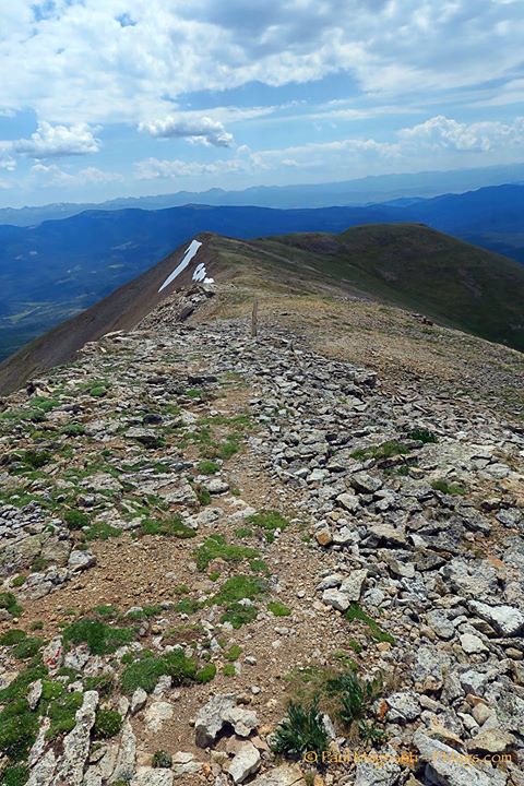
Easy enough to gain the CDT on the ridge line. The trail was obvious on the ridge. The views were good.


And a ridge walk on wide open tundra has to be one the of the great pleasures of backpacking.

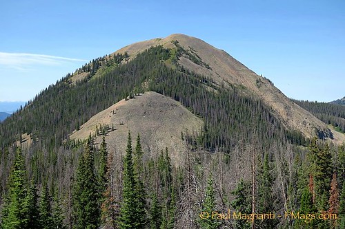
I soon reached the summit of Parkview Mountain. The historic fire lookout was a lone sentinel over the range.

I could see the route ahead that would lead the way back to my vehicle.

I enjoyed the vista. The solitude. The quiet. I had it all to myself.
Well, except for one opportunistic creature!

Time to head down. One last look was taken back to the summit.

The forest service road was mainly over grown. An expected trail? A faint track that faded in and out. Occasionally some survey tape marked the “trail” every-so-often.

I ended up following an obvious drainage. Good enough. It lead to where another trail was on the map. But not in reality.

No surprise, I picked up real trail again near some obvious hunter or horse packer camps. I suspect they do most of the, probably unofficial, maintenance.
This is not a statement of complaint. Rather it is an obswevation to show the reality on the ground. I expect more of our public lands in the near future to be what I experienced this weekend.
I followed the now obvious trail back to my vehicle. A little more of a jaunt than I anticipated. But a very good one.
…on the other hand if you like solitude, more and more land is waiting for you 😉
…but then again those well-known trailheads and trails wear out….
Notice I did not name the “trail” I took. This was not an accident. 😉
Definitely a blessing and curse. In many areas where undergrowth is just not human friendly without a trail I find the bushwhack not with the effort to reach the good stuff. Frustrating but understandable.